Hiking to Devil's Well (Pozo del Diablo) — UCV Maracay, Venezuela 🏞️🐒🎑
16
About :
The Devil's Well is located adjacent to the grounds of the Central University of Venezuela, at its Maracay campus, where the Faculties of Agronomy and Veterinary Medicine are located. To get there it is necessary to enter the university and walk a few minutes through the university and then reach the grounds, located north of the city of Maracay. This site is located, if I'm not mistaken, right on the limits of the Henry Pittier National Park, the oldest natural reserve in the country. In this #3Speak video I'll show you what was my experience doing this hiking trail, which I recommend if you live in Aragua State or nearby areas.
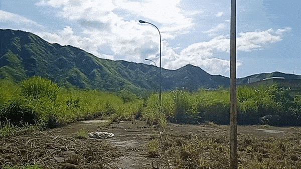
This hiking trail is about 5 km long (from the entrance of the university). The path inside the university is approximately 1.30 Km. After that, you have to walk about 2.5 km along the internal roads of the university grounds. It is an asphalt road in relatively good condition. On the way you will find a small abandoned guard house that can serve as a resting place, and it was just the one we used to take a break in this tour. That's where I took the GIF shot you see below.
El Pozo del Diablo se encuentra ubicado en las adyacencias de los terrenos de la Universidad Central de Venezuela, en su sede de Maracay, en donde se encuentran las Facultades de Agronomía y Veterinaria. Para llegar allí es necesario ingresar a la universidad y caminar unos minutos a través de ella para luego llegar a los terrenos pertenecientes a la misma, ubicados al norte de la ciudad de Maracay. Este sitio se encuentra ubicado, si no me equivoco, justo en los límites del Parque Nacional Henry Pittier, la reserva natural más antigua del país. En este video de #3Speak te mostraré lo que fue mi experiencia realizando este ruta de senderismo, la cual te recomiendo si vives en el Estado Aragua o zonas cercanas.
Esta ruta de senderismo posee alrededor de 5 Km de recorrido (desde la entrada de la universidad). El camino dentro de la universidad es de aproximadamente 1,30 Km. Luego de ello, se deben caminar alrededor de 2,5 Km por los caminos internos de los terrenos de la universidad. Es un camino asfaltado en condiciones relativamente buenas. En el camino podrás encontrarte con una pequeña caseta de vigilancia abandonada que puede servirte para sitio de descanso, y fue justo la que utilizamos para hacer una pausa en este recorrido. Allí fue donde realicé la toma del GIF que ves acá abajo.
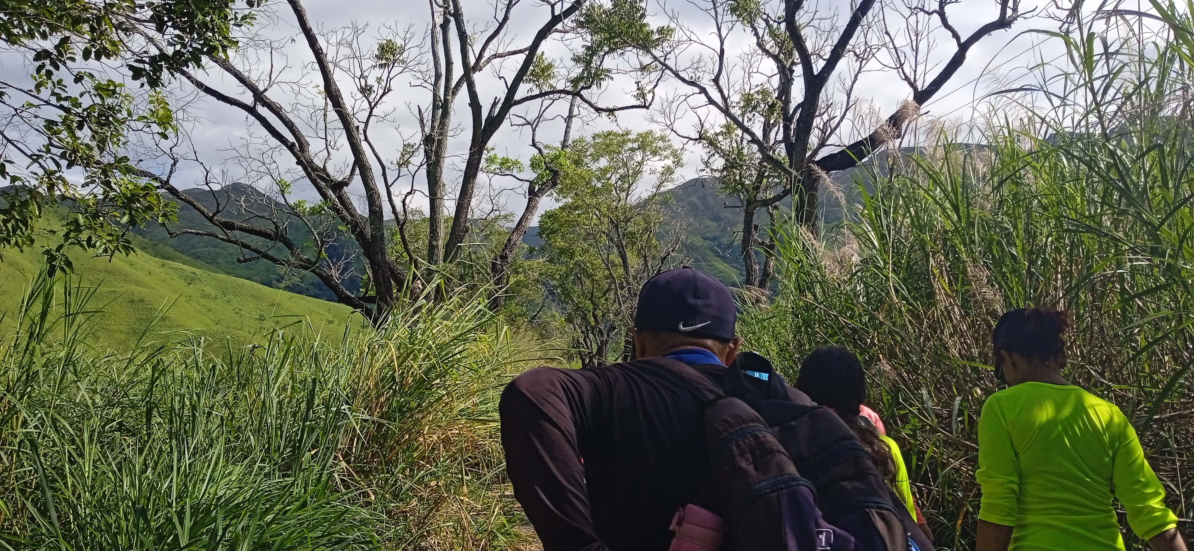
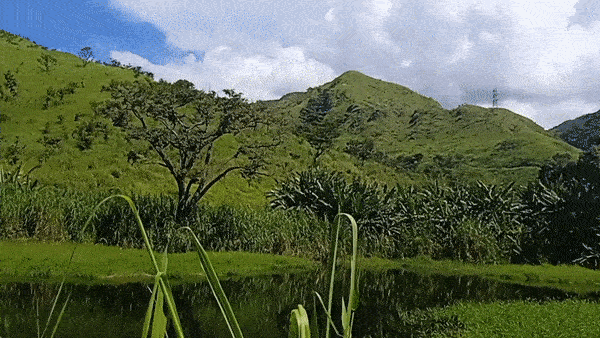
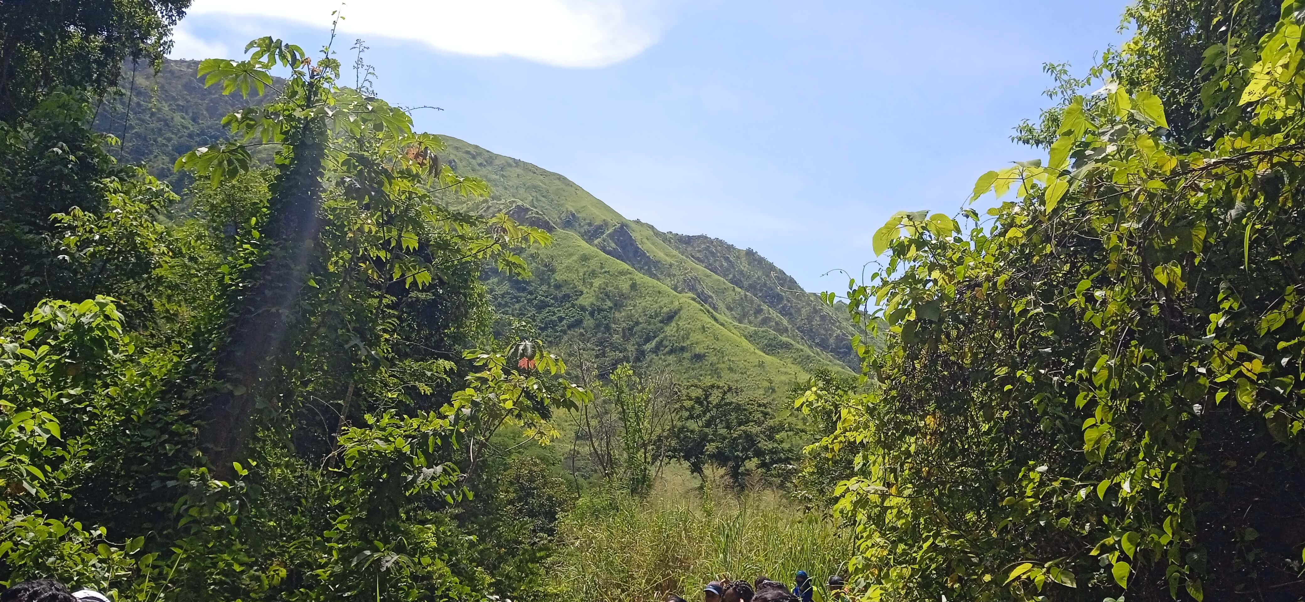
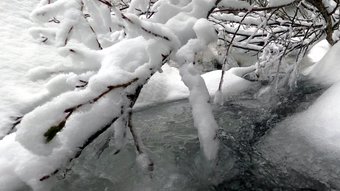
A few minutes after this area, where you can see a beautiful landscape of hills on the left (very similar to the hills in the background of Windows screens), the road starts to become very narrow and very tall vegetation covers both sides. But this is compensated when you come across a small pond and very colorful landscapes. You can see this in the animation above. It is said that in this lagoon there are "babas" or small caimans, but I didn't manage to spot any. After the lagoon, we will continue along very narrow roads where the vegetation covers both sides of the road, and is so high that in some places you can see practically nothing of the horizon. At some points the road literally turns into a tunnel because of the height of the vegetation. All this is perhaps due to the time of year, when there are frequent and heavy rains.
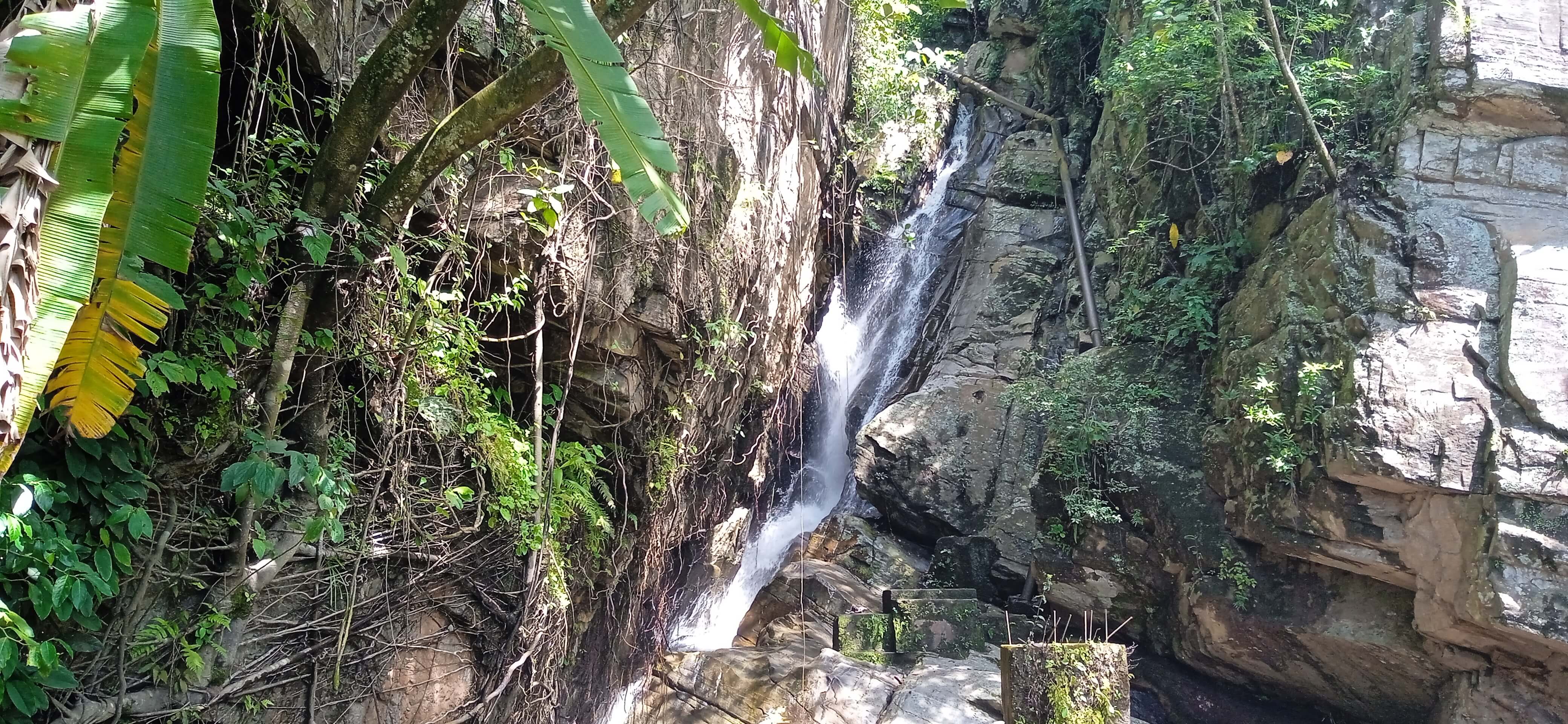
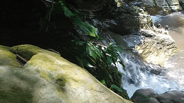
It was a very pleasant and interesting experience, although I think this road is not suitable for claustrophobics. It is about 20 minutes of walking on a very narrow path which at the end begins to steepen slightly. But the reward comes when you can hear the sound of water crashing against the stones, and suddenly you can see the waterfall and the first well of the route. It is a very cool place, in which there are abandoned concrete structures, which I wonder what they were made for. You can also see a pipe parallel to the waterfall and it is impressive that it could have been made in a place of difficult access and maneuvering.
Pocos minutos después de esta zona, en donde puedes observar un hermoso paisaje de colinas a la izquierda (muy parecido a las colinas del fondo de pantallas de Windows), el camino empieza a hacerse muy estrecho y vegetación muy alta cubre ambos lados. Pero esto se compensa cuando te encuentras con una pequeña laguna y paisajes muy vistosos. Esto lo puedes observar en la animación de arriba. Se dice que en esa laguna hay "babas" o caimanes pequeños, pero no logré divisar nada. Luego de la laguna, seguiremos por caminos muy estrechos en donde la vegetación cubre ambos lados del camino, y es tan alta que en algunos sitios no se puede ver prácticamente nada del horizonte. En algunos puntos incluso el camino se transforma literalmente en un túnel de lo alta que la vegetación es. Todo esto quizás se debe a la época del año, en donde se dan lluvias frecuentes y de alta intensidad.
Fue una experiencia muy agradable e interesante, aunque creo que este camino no es apto para claustrofóbicos. Son aproximadamente 20 minutos de recorrido en un camino muy estrecho el cual al final empieza a empinarse ligeramente. Pero la recompensa llega cuando se puede escuchar cerca el ruido del agua que choca contra las piedras, y, de repente, ya puedes divisar la cascada y el primer pozo del recorrido. Es un sitio muy fresco, en el cual existen estructuras de concreto abandonadas, las cuales me pregunto para qué fueron hechas. También se puede ver una tubería paralela a la cascada y es impresionante que se haya podido hacer en un sitio de difícil acceso y maniobra.
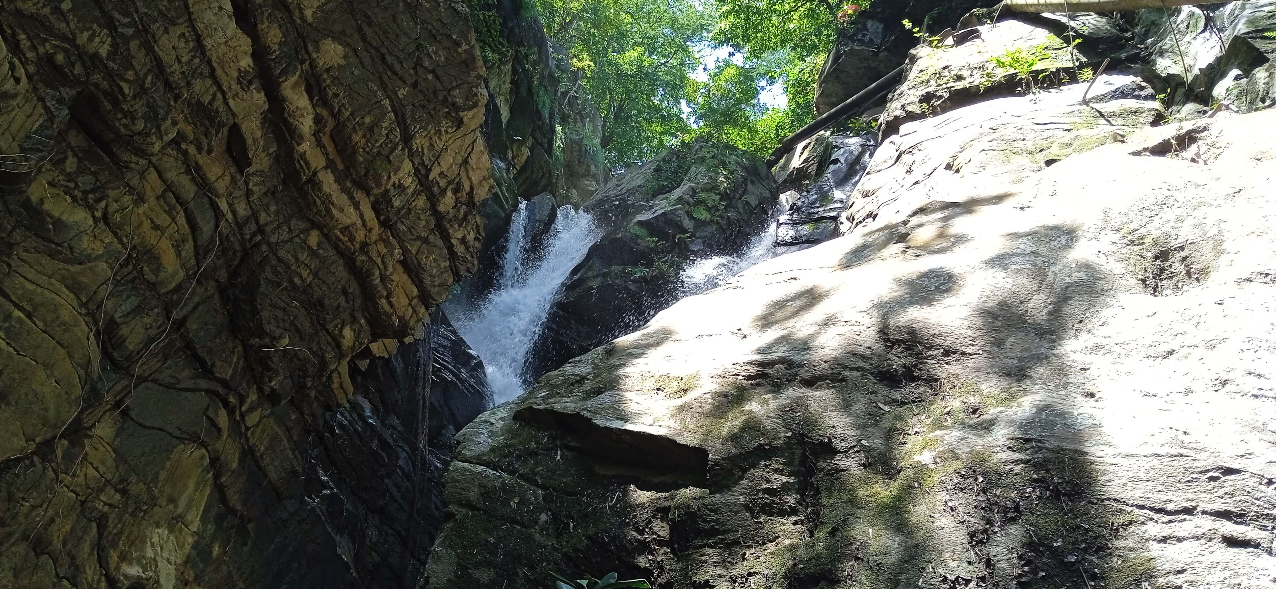
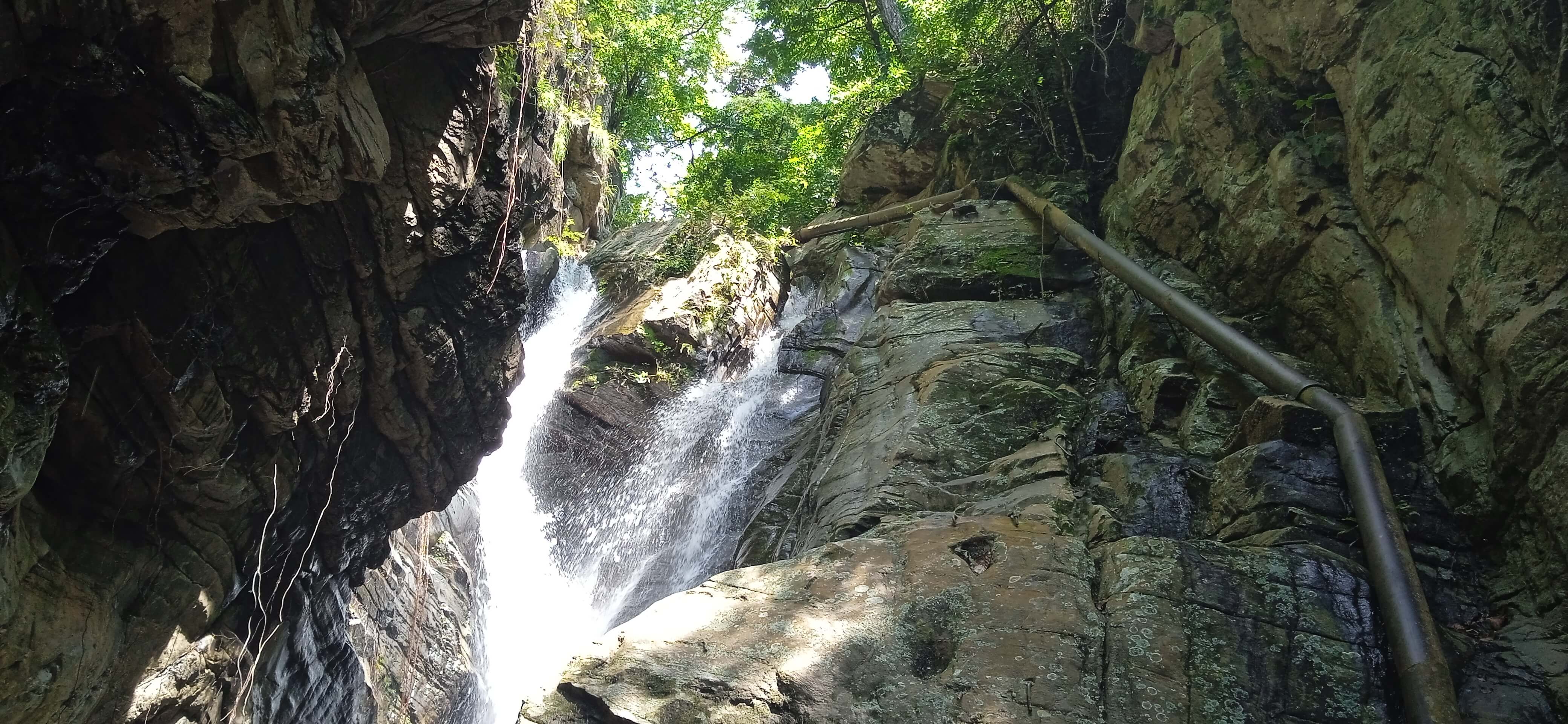
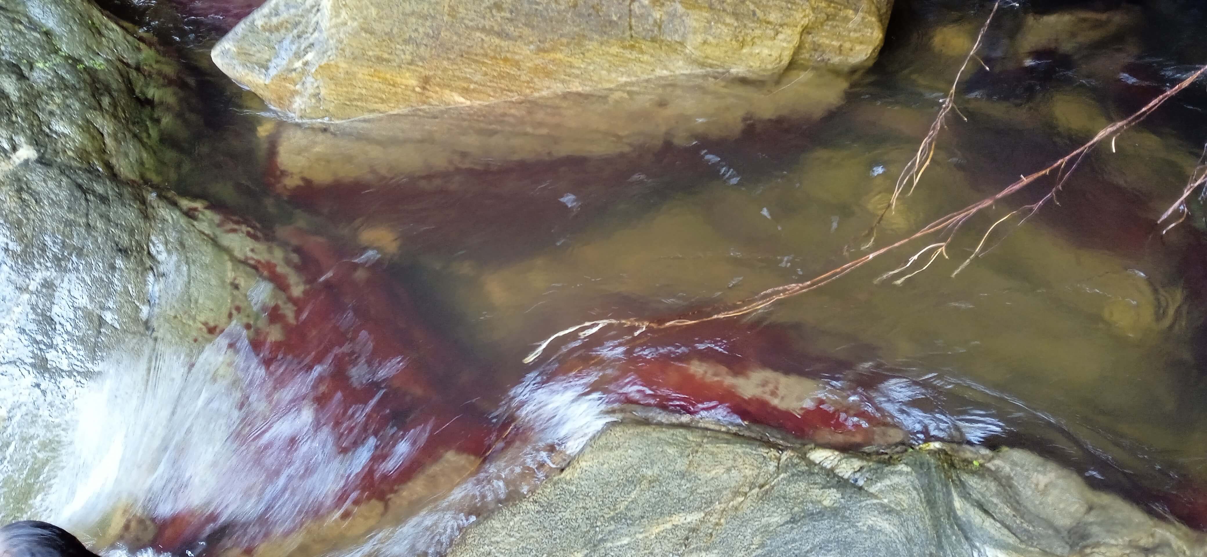
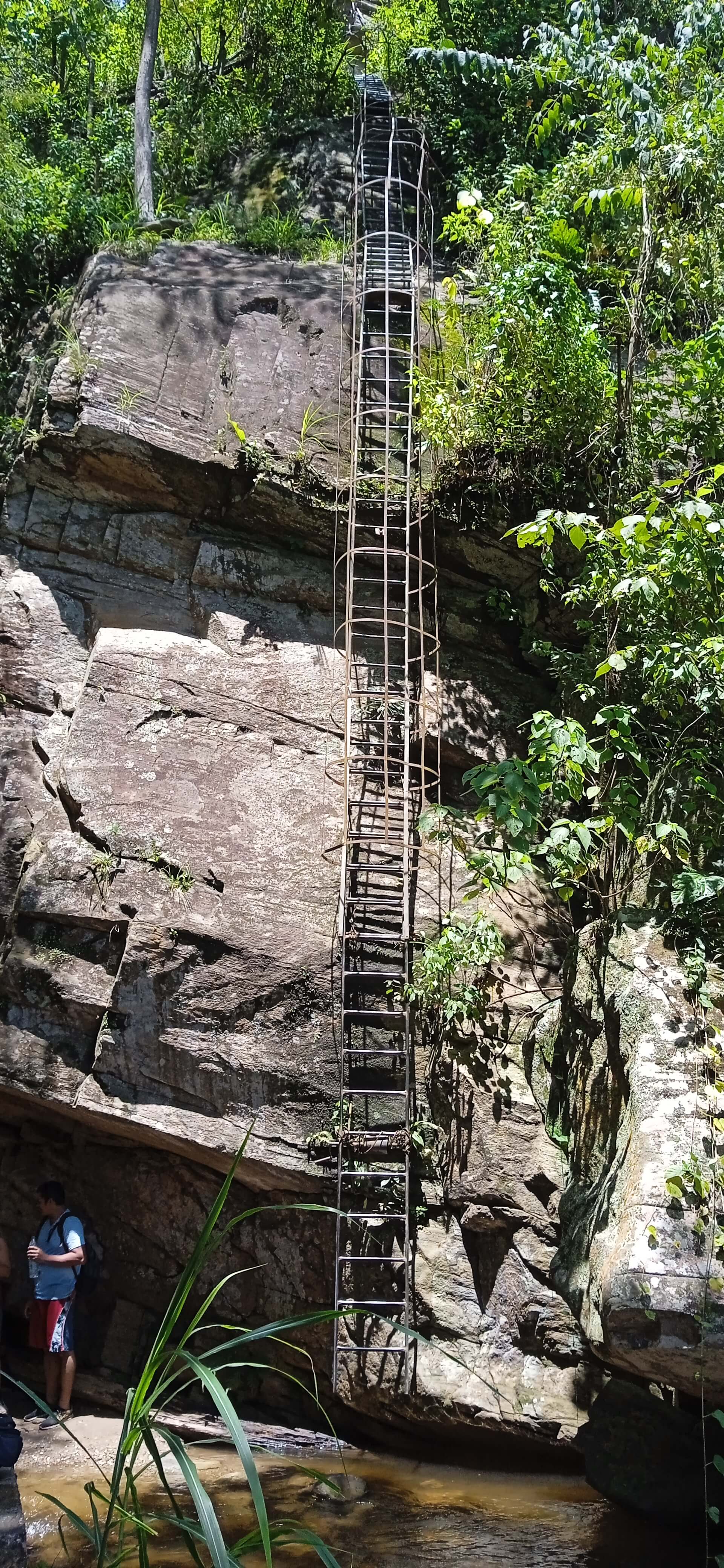
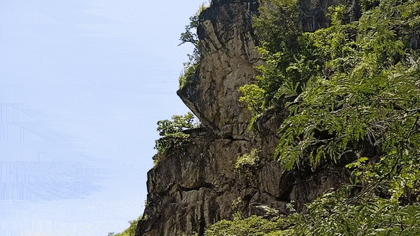
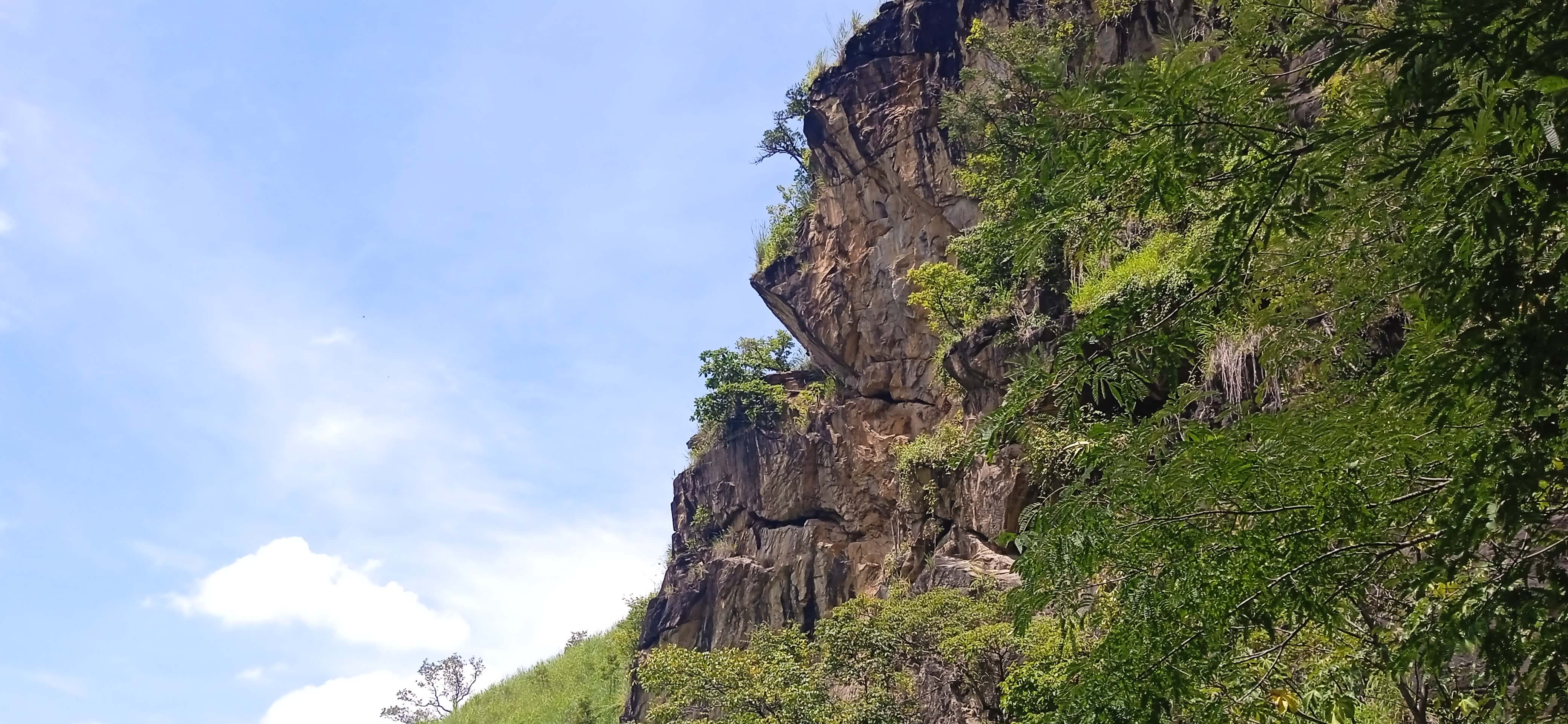
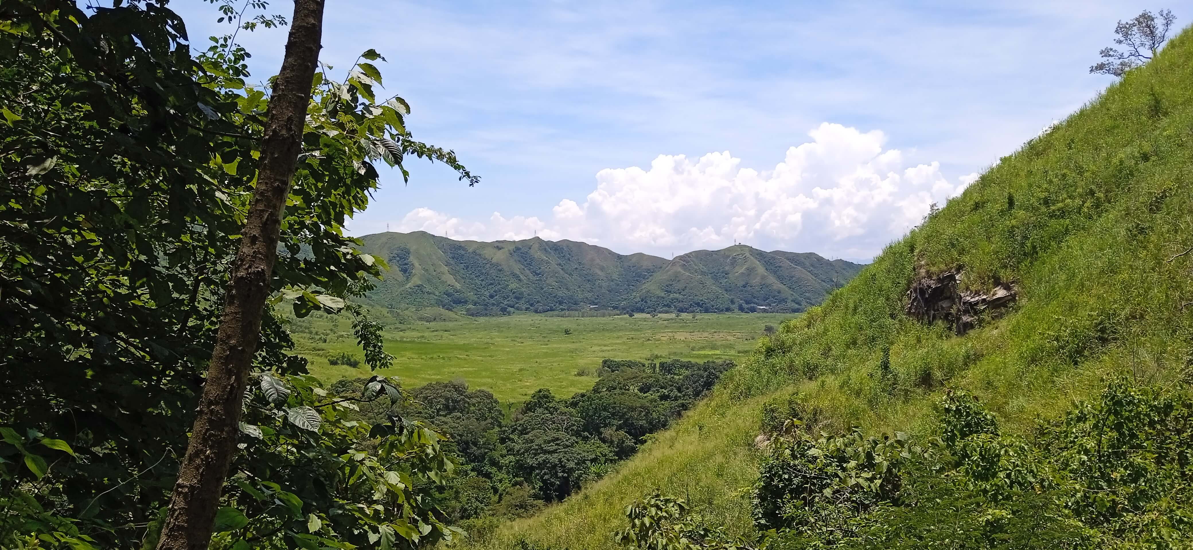
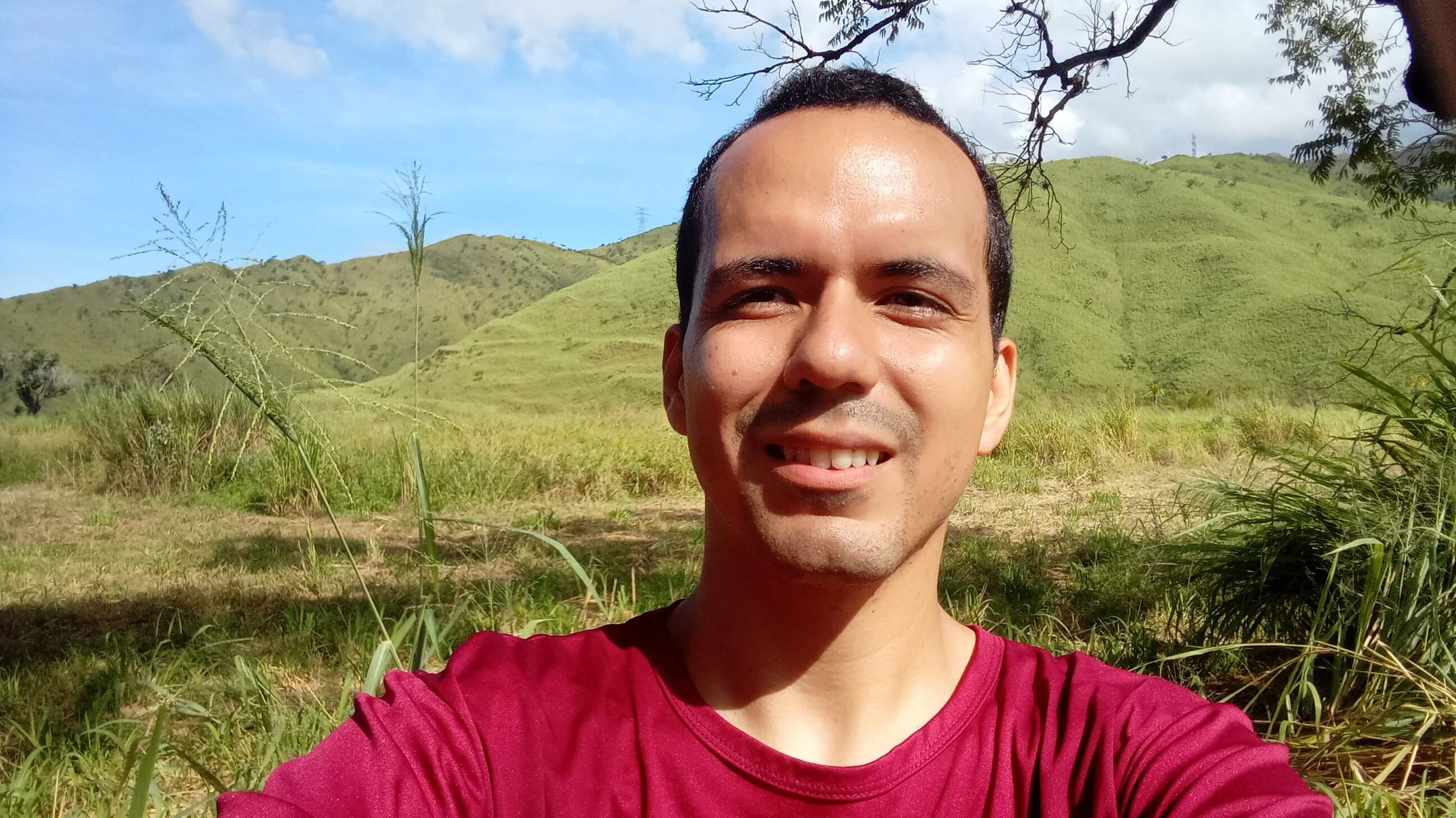
In this first well you can clearly see a staircase leading further up the mountain, through a stone wall. The staircase is a bit vertiginous, but it is relatively easy to climb. I don't know why this place is called Pozo del Diablo, but perhaps it is due to the reddish color of some of the stones here. At the top of the stairs, we can see a beautiful view of the valley north of the city of Maracay, precisely the image on the cover of this publication. There is also a rocky cliff overlooking. After this, there is approximately 10 minutes of travel on a slightly dangerous road to reach the second well. There I was not able to record for obvious reasons, as you have to concentrate on standing well on the path.
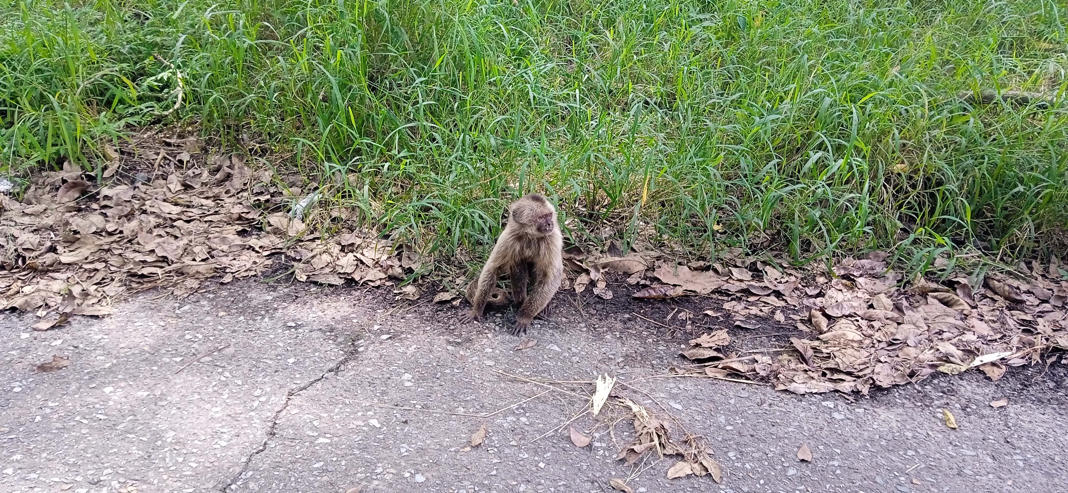
The second well is a bit bigger and is a kind of natural pool where people can bathe. We were about 50 people, of which about 10 or 15 stayed down in the second pool and the rest of us made it to the second one. The tour reached this point, at noon we had to return, although I understand that up there are more wells and sites to visit as we go up the mountain. On the way back our friend the capuchin monkey was not waiting for us.
En este primer pozo se puede observar claramente una escalera que lleva a más arriba en la montaña, a través de una pared de piedra. La escalera da un poco de vértigo, pero es relativamente fácil de subir. Desconozco porqué este sitio se llama Pozo del Diablo, pero quizás se debe al color rojizo que hay en algunas de las piedras del lugar. Ya arriba de la escalera, podemos visualizar una hermosa vista del valle al norte de la ciudad de Maracay, precisamente la imagen de la portada de esta publicación. También hay un risco rocoso que se asoma. Luego de esto, hay aproximadamente 10 minutos de recorrido por un camino un poco peligroso para llegar al segundo pozo. Allí no pude grabar por obvias razones, ya que debes concentrarte en estar bien parado en el camino.
El segundo pozo es un poco más grande y es una especie de piscina natural donde las personas pueden bañarse. Éramos aproximadamente 50 personas, de las cuales alrededor de 10 o 15 se quedaron abajo en el segundo pozo y el resto llegamos hasta el segundo. El recorrido llegó hasta aquí, en horas del mediodía ya debíamos regresar, aunque tengo entendido que arriba hay más pozos y sitios para visitar a medida que subimos en la montaña. Ya de regreso no esperaba nuestro amigo el mono capuchino.
I recently published a post about the Campus UCV Maracay and the current state of this important educational center in the country. I think it is important to highlight these sites which may not be well known by the public, and #Hive helps us to give them some presence on the Web, especially for their conservation and to raise awareness about them. I hope you enjoyed this video and photos. Tell me in the comments, would you visit this site?
Recientemente publiqué un post acerca de la UCV Maracay y el estado actual de este centro educativo importante del país. Me parece importante resaltar estos sitios los cuales puede que no sean muy conocidos por el público, y #Hive nos ayuda a darles cierta presencia en la Web, especialmente para su conservación y generar consciencia acerca de ellos. Espero que hayas disfrutado de este video y fotos. Cuéntame en los comentarios ¿Visitarías este sitio?
Translated to English language with the help of DeepL.com
Photographs of own authorship / Fotografías de autoría propia (Redmi 9C).
Source of satellite images / Fuente de imágenes satelitales en el video: Google Maps
GIFs creados mediante ezgif.
Otras redes sociales:
 |
 |
 |
 |
F1 & motorsports: @acontmotor
Secondary Blog: @acontblog
| ¡Gracias por visitar! — ¡Thanks for visiting!  |
Show more
Tags :
Woo!
This creator can upvote comments using 3speak's stake today because they are a top performing creator!
Leave a quality comment relating to their content and you could receive an upvote
worth at least a dollar.
Their limit for today is $0!
Their limit for today is $0!

27 views
2 years ago
$

20 views
3 years ago
$

13 views
8 months ago
$

3 views
a year ago
$

13 views
2 years ago
$
More Videos

26 views
2 years ago
$

28 views
a year ago
$

12 views
3 years ago
$

81 views
5 months ago
$

1 views
2 years ago
$

6 views
a year ago
$

1 views
a year ago
$

27 views
2 years ago
$

9 views
11 months ago
$

1 views
2 years ago
$

28 views
10 months ago
$
1 views
a month ago
$

7 views
2 years ago
$

31 views
a year ago
$

7 views
2 years ago
$

19 views
a year ago
$

14 views
5 months ago
$

13 views
a year ago
$

18 views
a year ago
$

9 views
9 months ago
$
4 views
6 months ago
$

19 views
a year ago
$
2 views
2 years ago
$

23 views
3 months ago
$

9 views
3 months ago
$
Comments:
Reply:
To comment on this video please connect a HIVE account to your profile: Connect HIVE Account