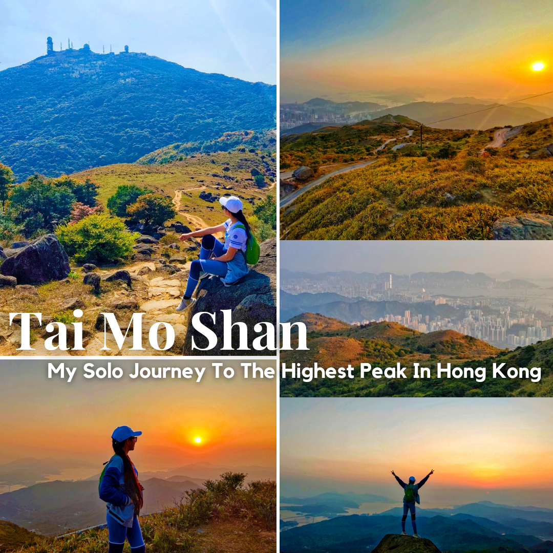
Tai Mo Shan: My Solo Journey To The Highest Peak In Hong Kong (The Final Adventure)
10
About :
April 16, 2023
"The best view comes after the hardest climb."
I must admit that my hike to the highest mountain in Hong Kong was the most excruciating, yet, was the most worthy hike. The summit has the most beautiful view as well, and this proved the adage above, the best view comes after the hardest climb.
Come and join me on my final journey to the highest peak in Hong Kong - Tai Mo Shan.
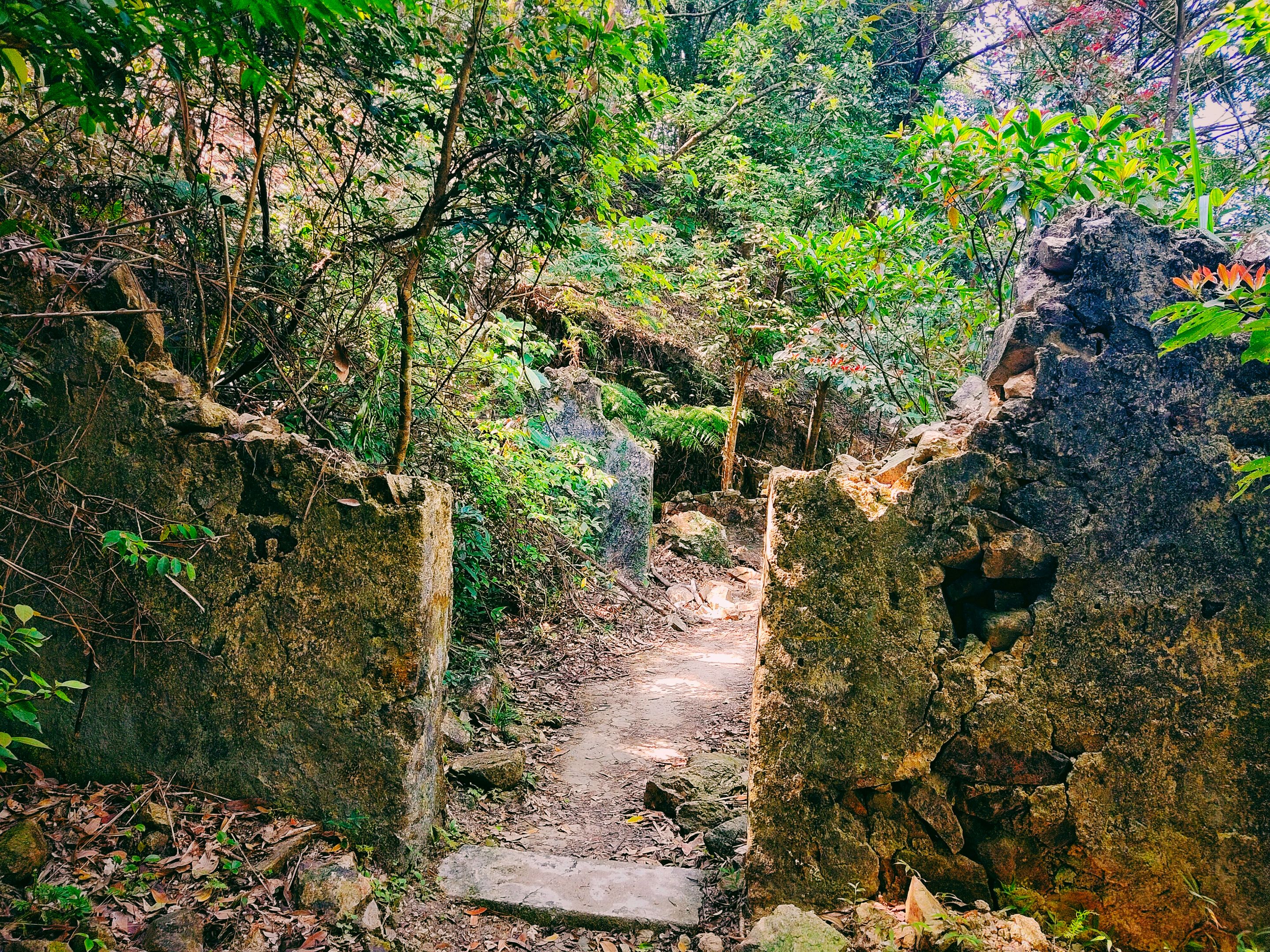
After passing through the series of waterfalls, the first tough part of my journey has been surpassed. Yet, another problem came up when I stumbled upon an intersecting trail with no signs of the right direction. I froze at the moment and worried about the situation as I didn't want to get lost in the trail again. No internet connection means no Google Maps and couldn't access the article guide.
For a while, I stayed and studied the trails well. The summit is, of course, at the peak of the mountain. Thus, the trail must be going up so I thought of choosing the left one. However, for the first time, I got scared of it so I halted. The right trail was flat, yet there could be an ascending trail ahead. I thought of checking it first but I only saw concrete broken parts of something built there in the past. What could this be? It added to my thoughts while looking for the right trail.
I stayed for a while in this spot as I truly sensed something different that day and I didn't like the feeling. I felt hopeless at the same time and thought of going back. However, at the back of my mind was the desire to reach the summit of the highest peak in this country. Besides, I hiked far enough which would be a waste of effort and time if I discontinue.
I jumped out of my skin when I heard the crushing sound of withered leaves on the ground and approaching footsteps. I readied myself for the circumstances but I felt relieved when I spotted an old man coming in my direction. I felt grateful when he understood English so I asked about the right direction. My gut was right after all when he told me that the right trail was on the left and the way to the Tai Mo Shan peak was just 10 minutes ahead.
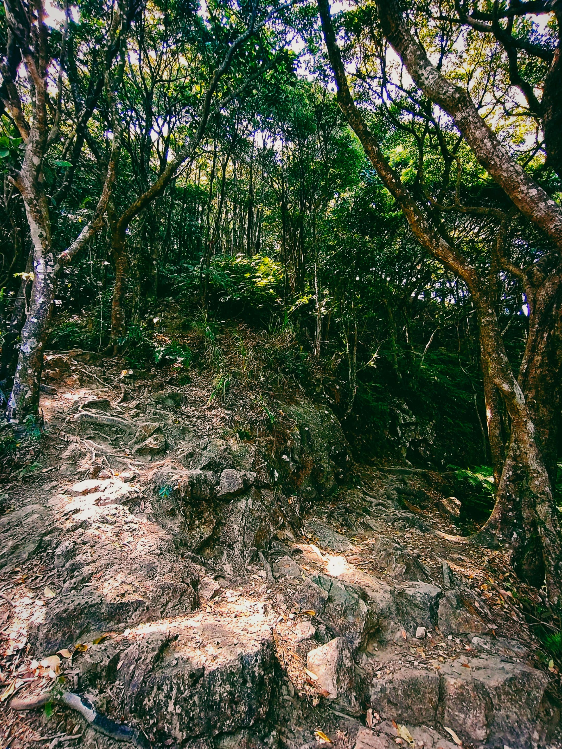
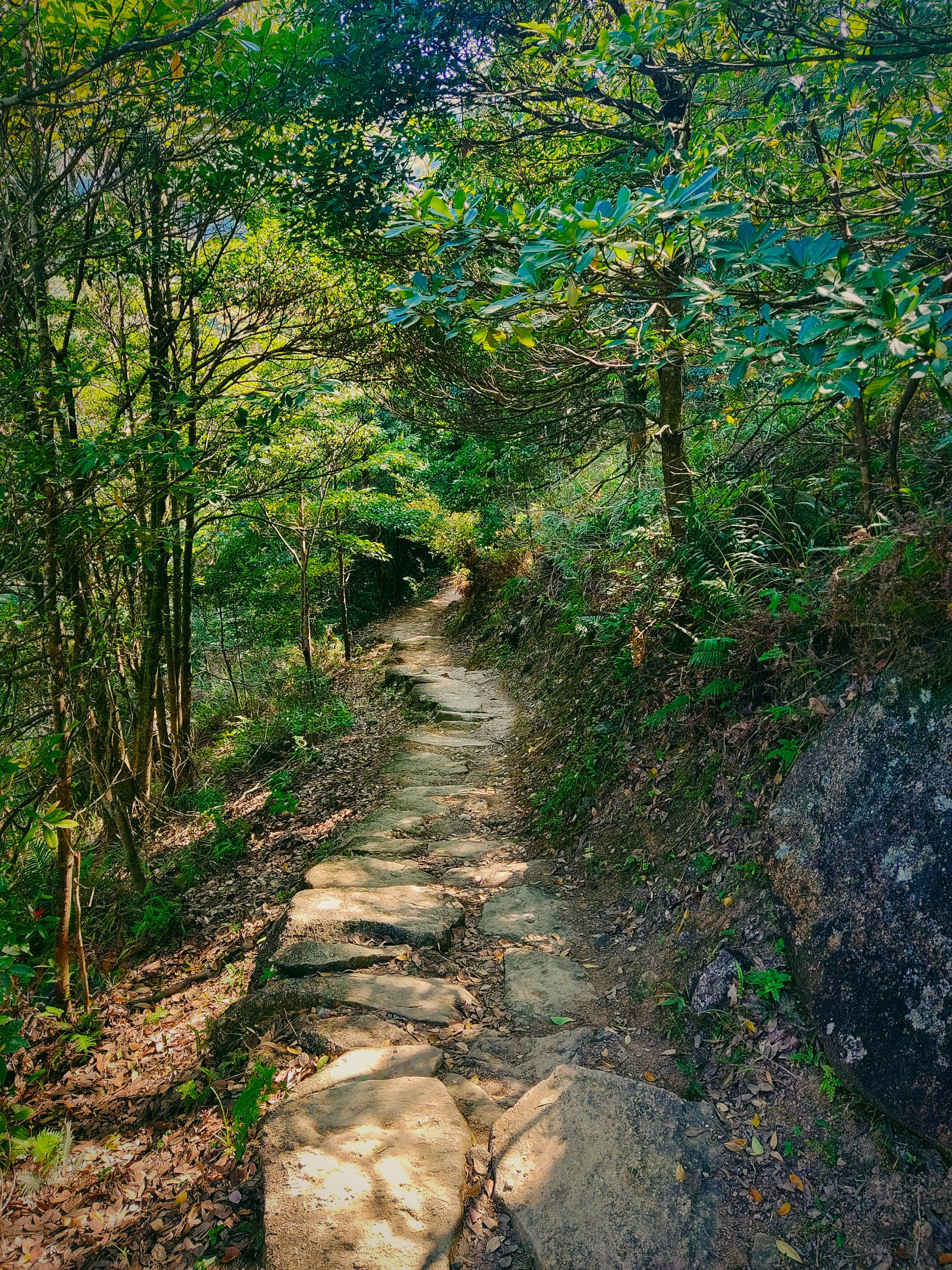
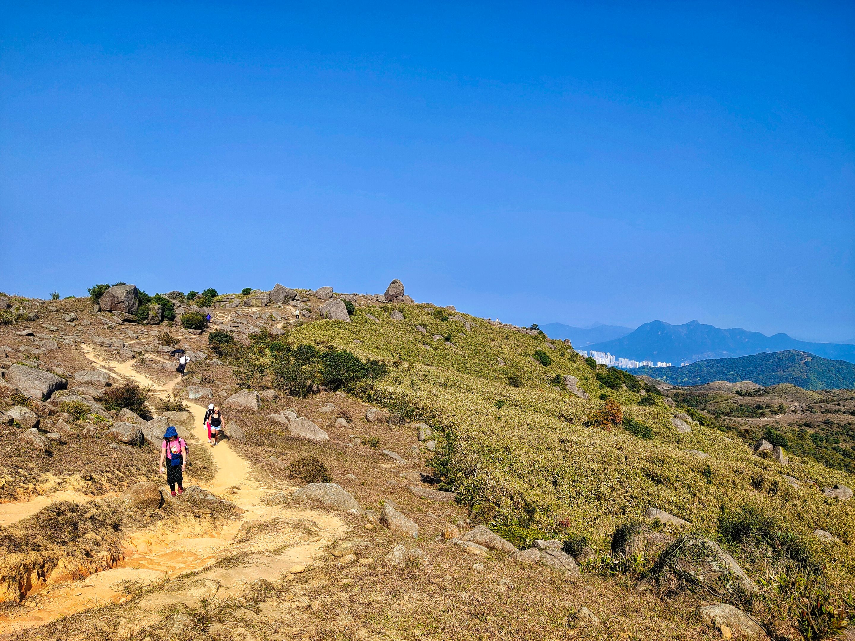
This trail truly was the wildest among all trails I climbed. But I can't deny its enchanting and nostalgic beauty perfect for photography.
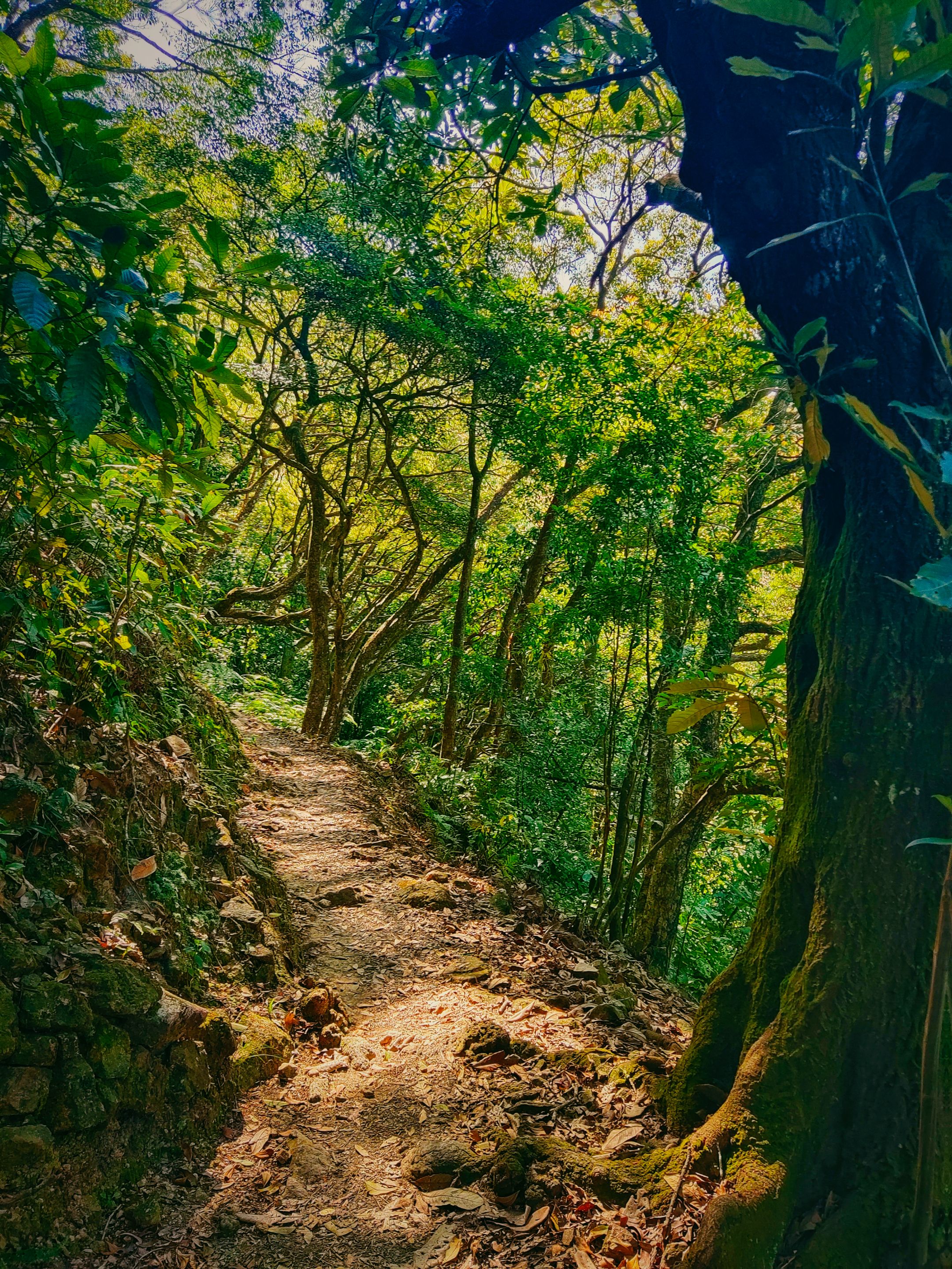
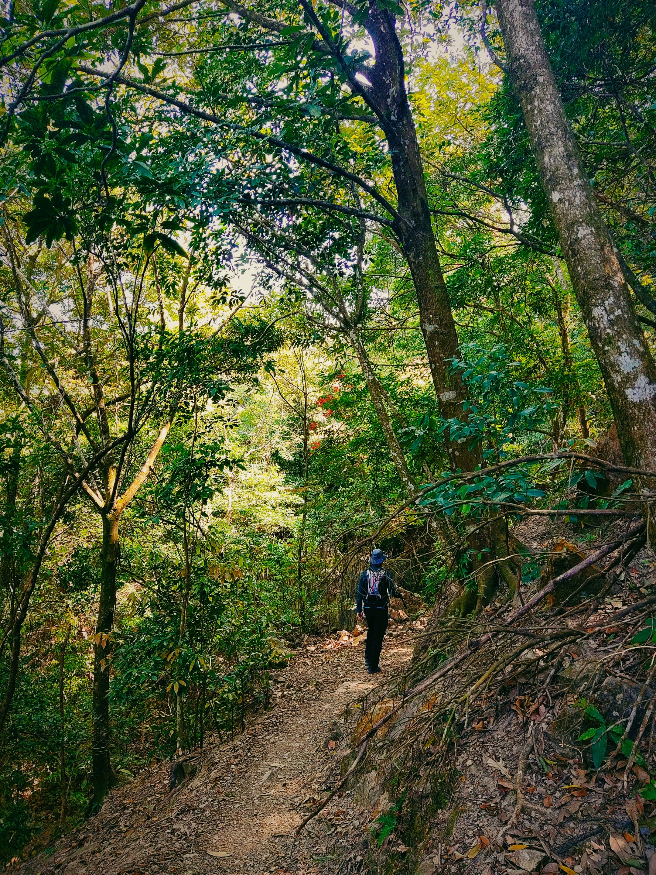
Ten minutes from the intersecting trails was this bamboo forest. There were a couple of foreigners who passed by while staying alone in this area. I thought, "Where were they when I was confused about the right trail earlier?" They came after me from the same direction. I let them pass by as I already felt confident that the trail ahead was pretty much easier to trace.
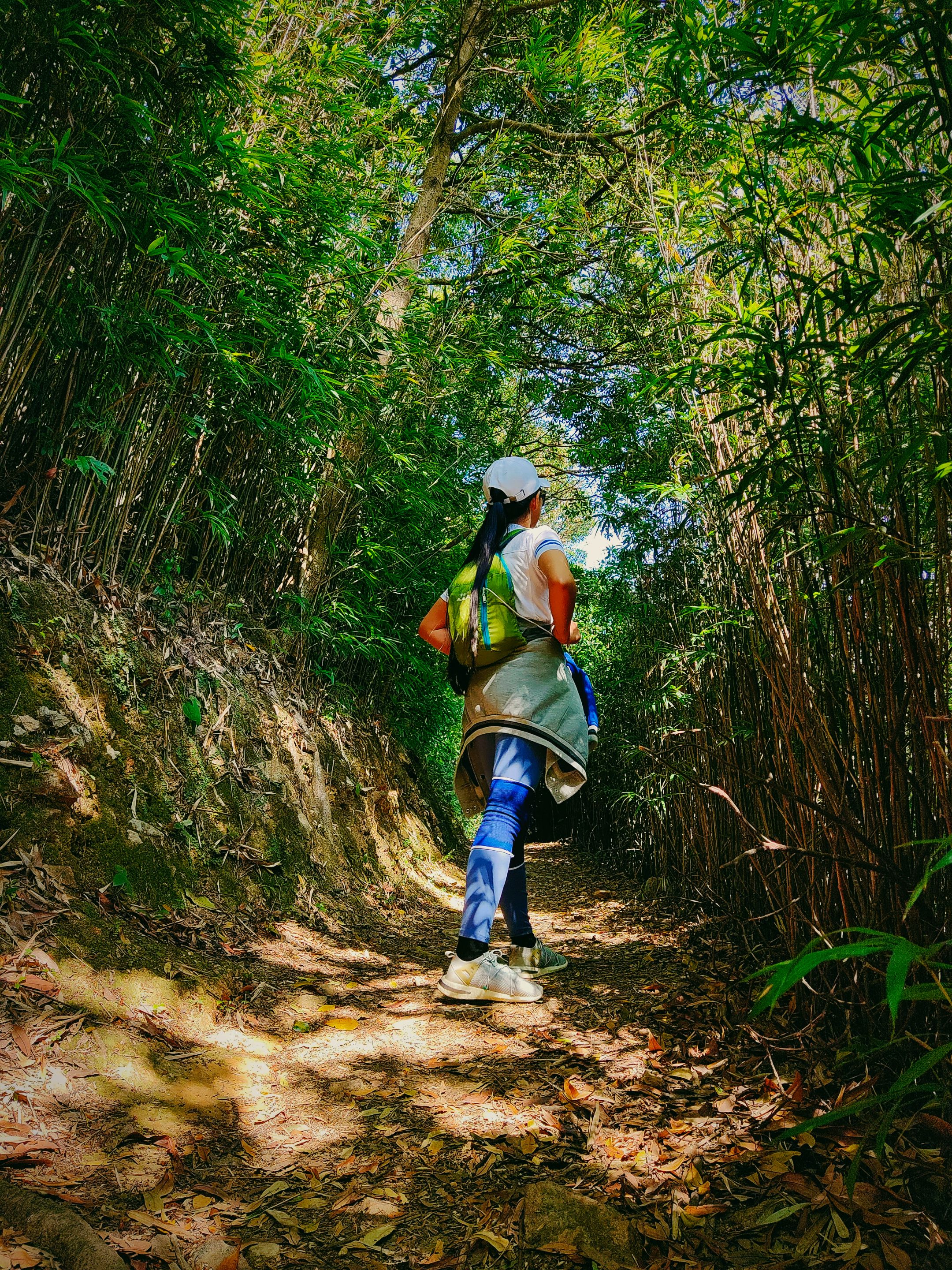
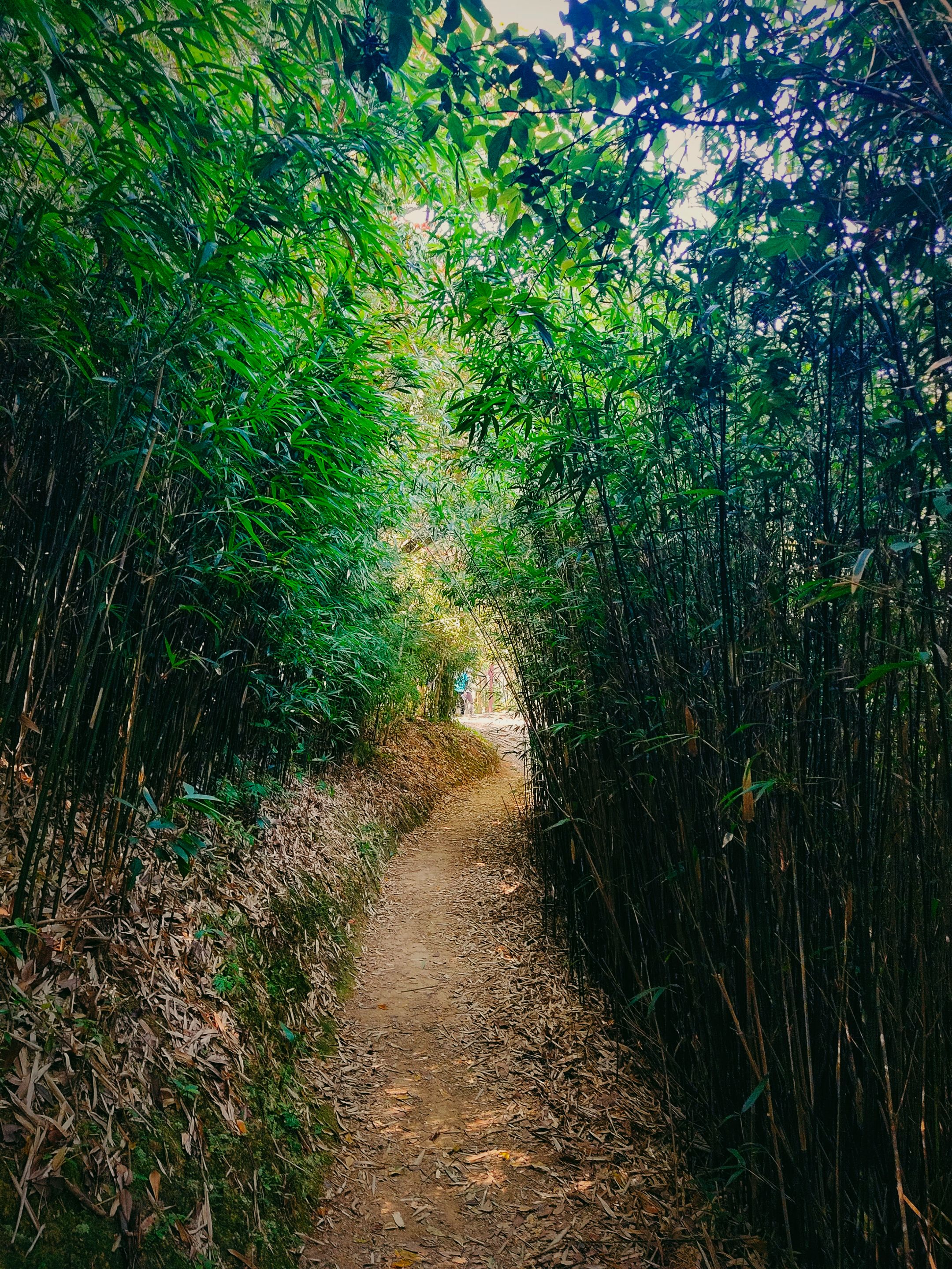
The man was right, after thirteen minutes (supposed to be ten but I spent some time in the bamboo forest), I finally spotted a direction post at the end of the bamboo forest. A group of old Chinese hikers was resting in the place. The group was from the summit's direction and going down to where I started.
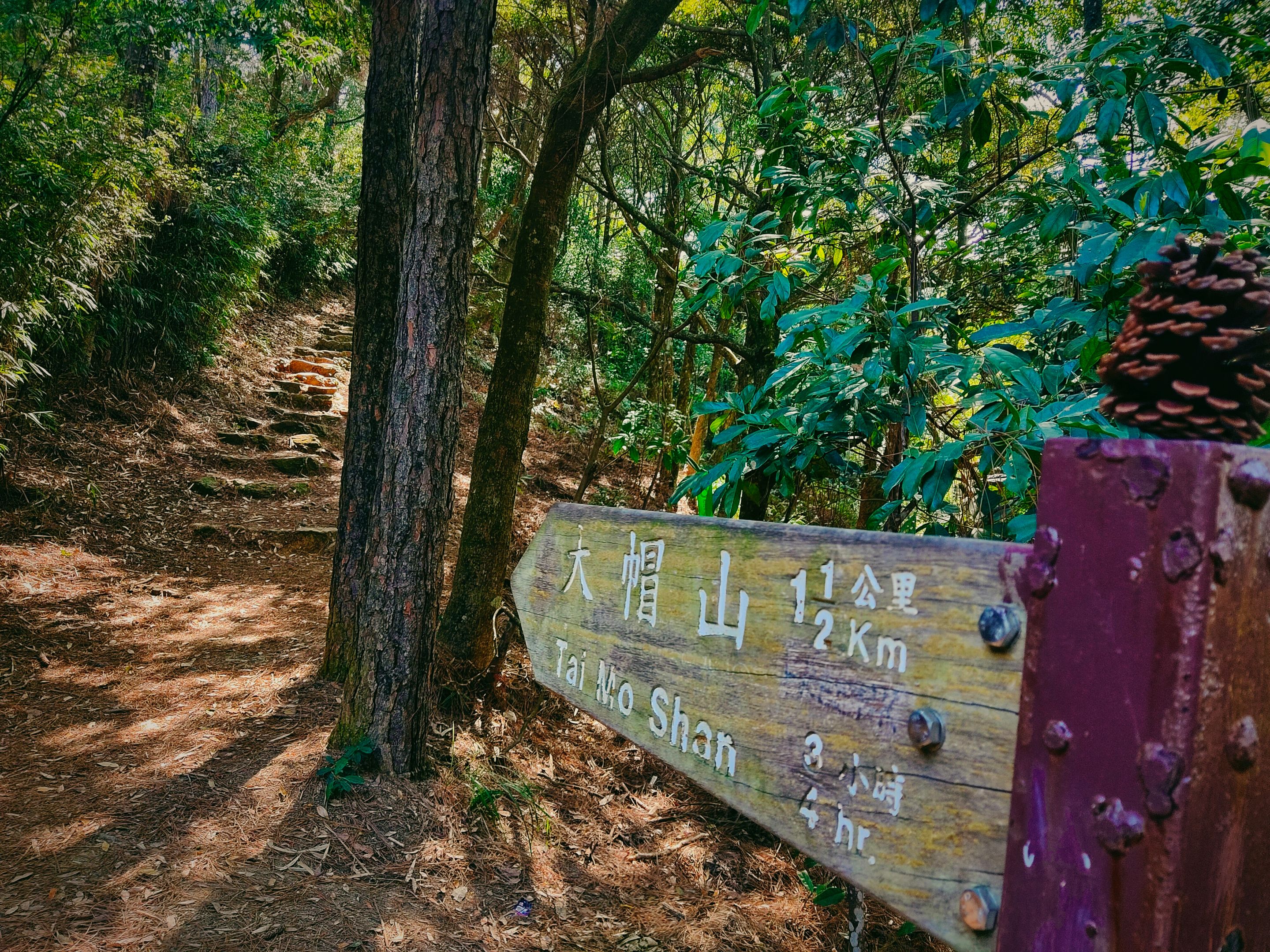
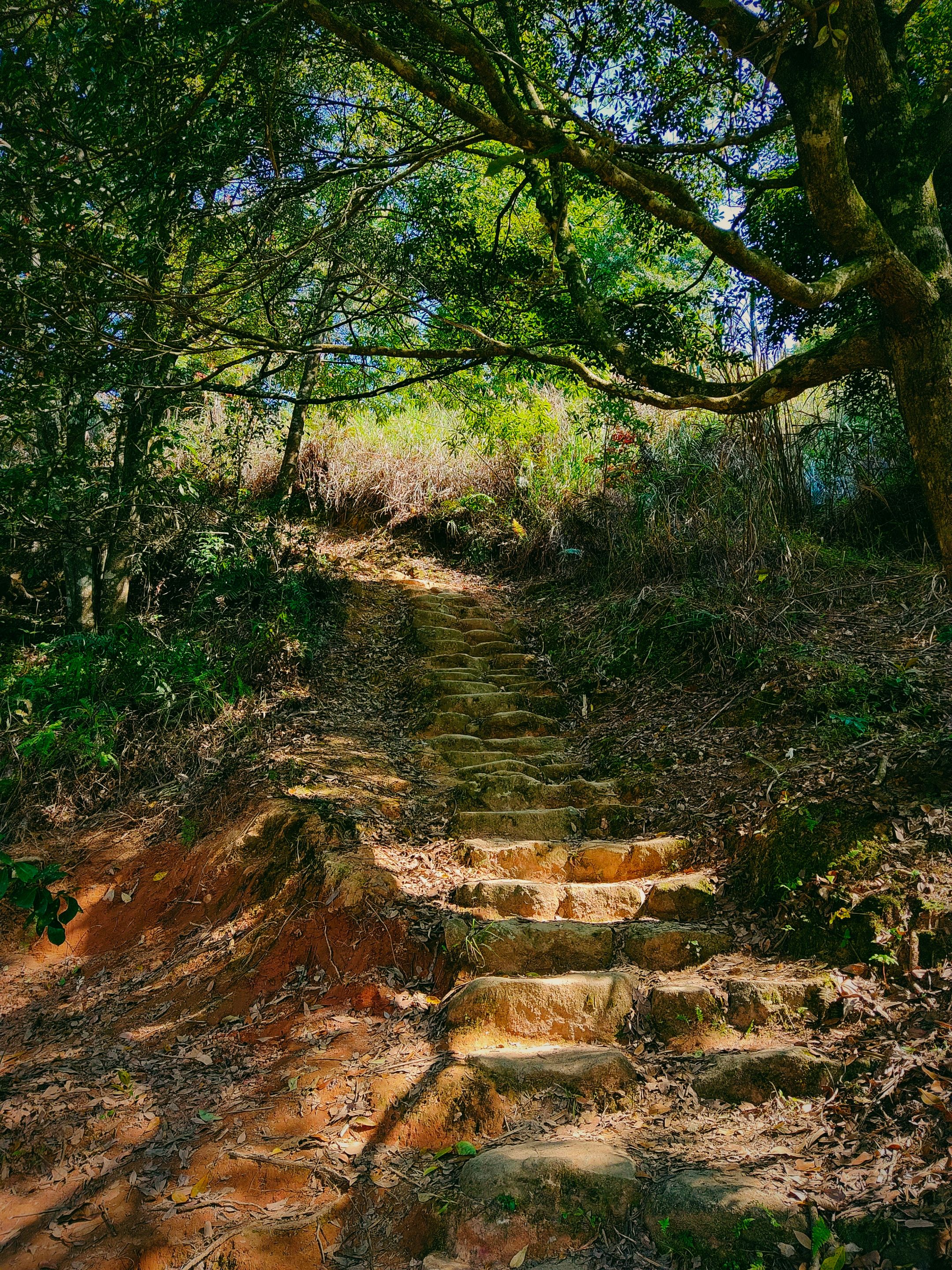
I stumbled into yet another rocky stairway which I thought would take yet another excruciating climb. At this point, more hikers were coming from both directions. I almost screw them as I thought, "Where were you guys when I needed some company?" Yet, the direction post says that the summit is only 3/4 hours or just 1½ Km ahead so I felt excited.
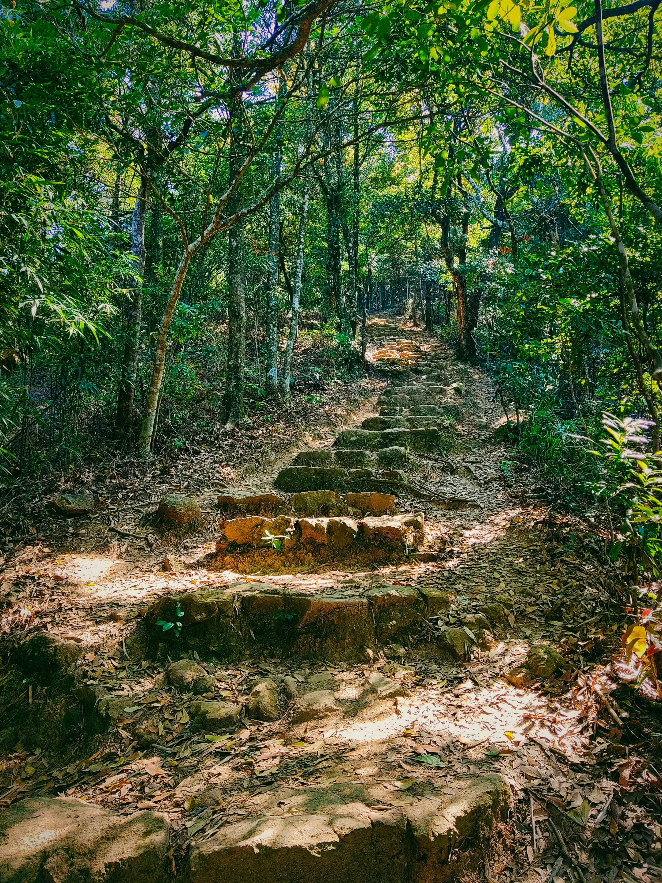
I was excited yet exhausted. There was a point when I exclaimed loudly upon seeing seemingly endless rocky stairs. I even called it the, rocky stairway to heaven. My muscles were almost cramping so I rested on the stairs for a while before they get worst.
 | |
|---|
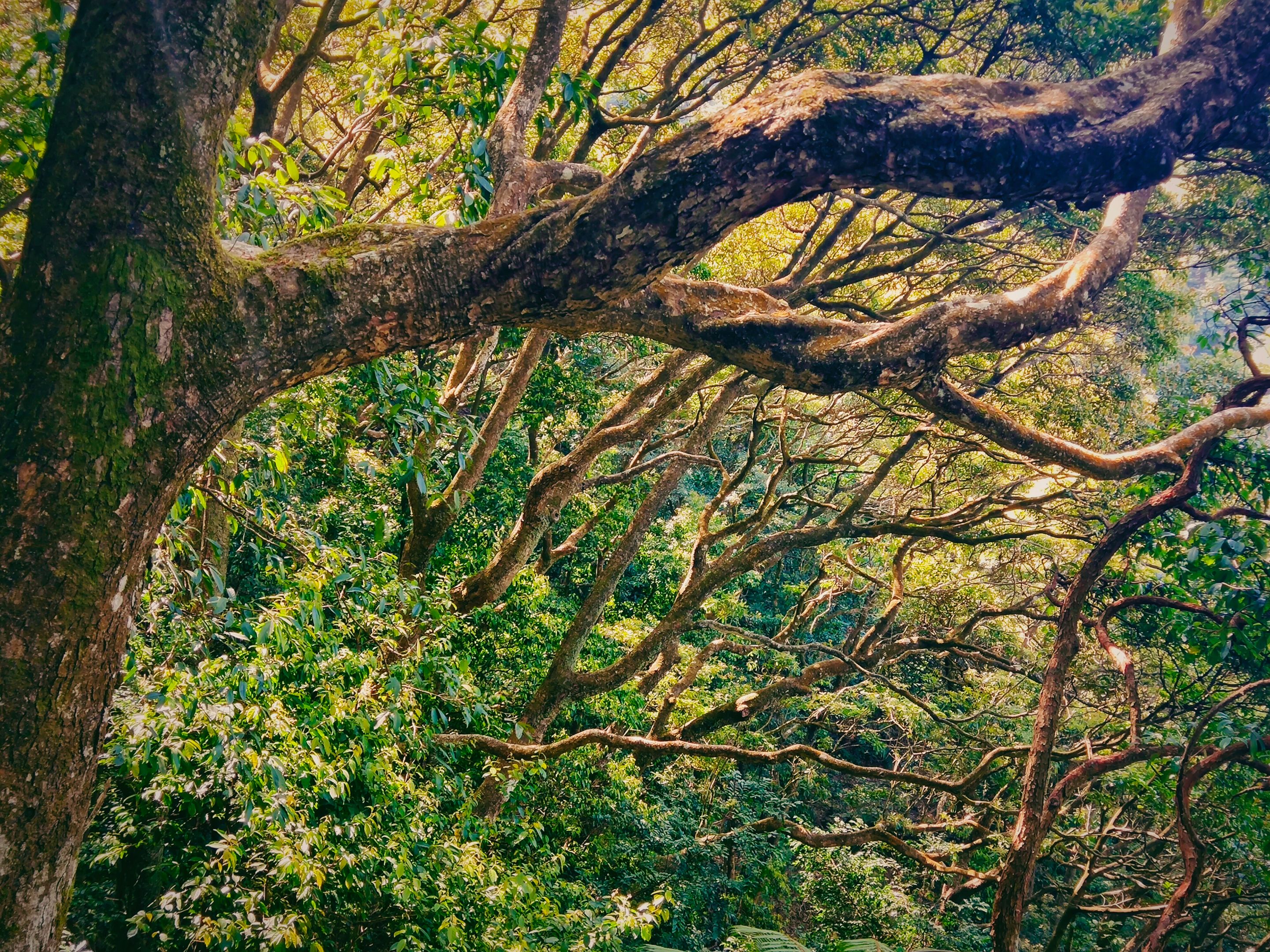
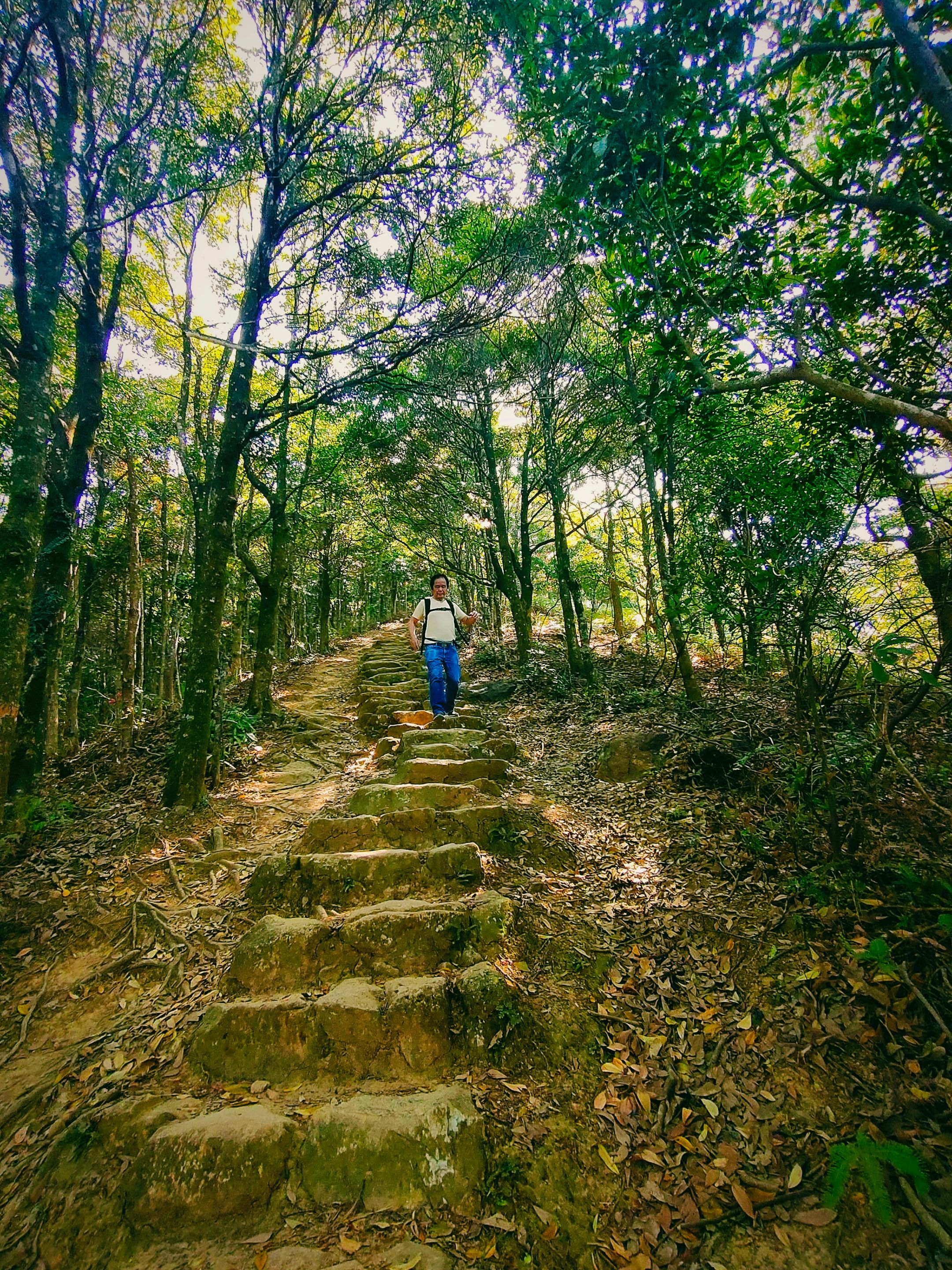
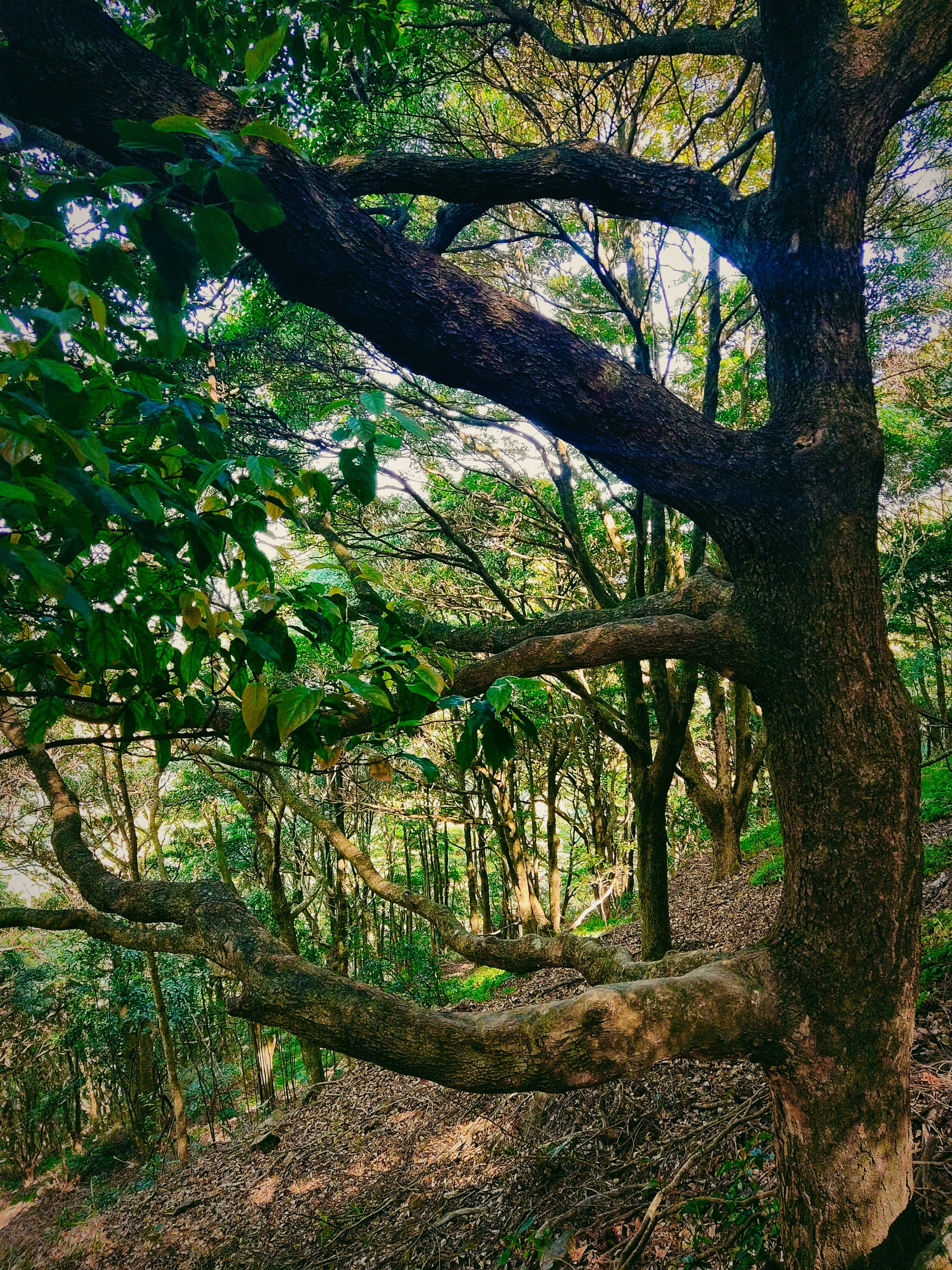
Before taking another stretch, I admired the enchanting beauty of the forest and wayward trees. The vibe somehow relieved my tiredness and inspired me to see more beautiful spots ahead.
I traced yet another narrow paved path followed by another set of rocky steps. After tracing this trail, a pile of hope was formed upon seeing the clear sky and brighter path.
 |  |
|---|
Relief after getting out of the jungle
It was such a huge relief after getting out of the jungle where the sky was covered by trees' thick canopies. After passing by a long stretch of ascending stairs and narrow paths, I finally reached the clearer trail where, on the left side, city and mountain views can be seen.
 |  |
|---|
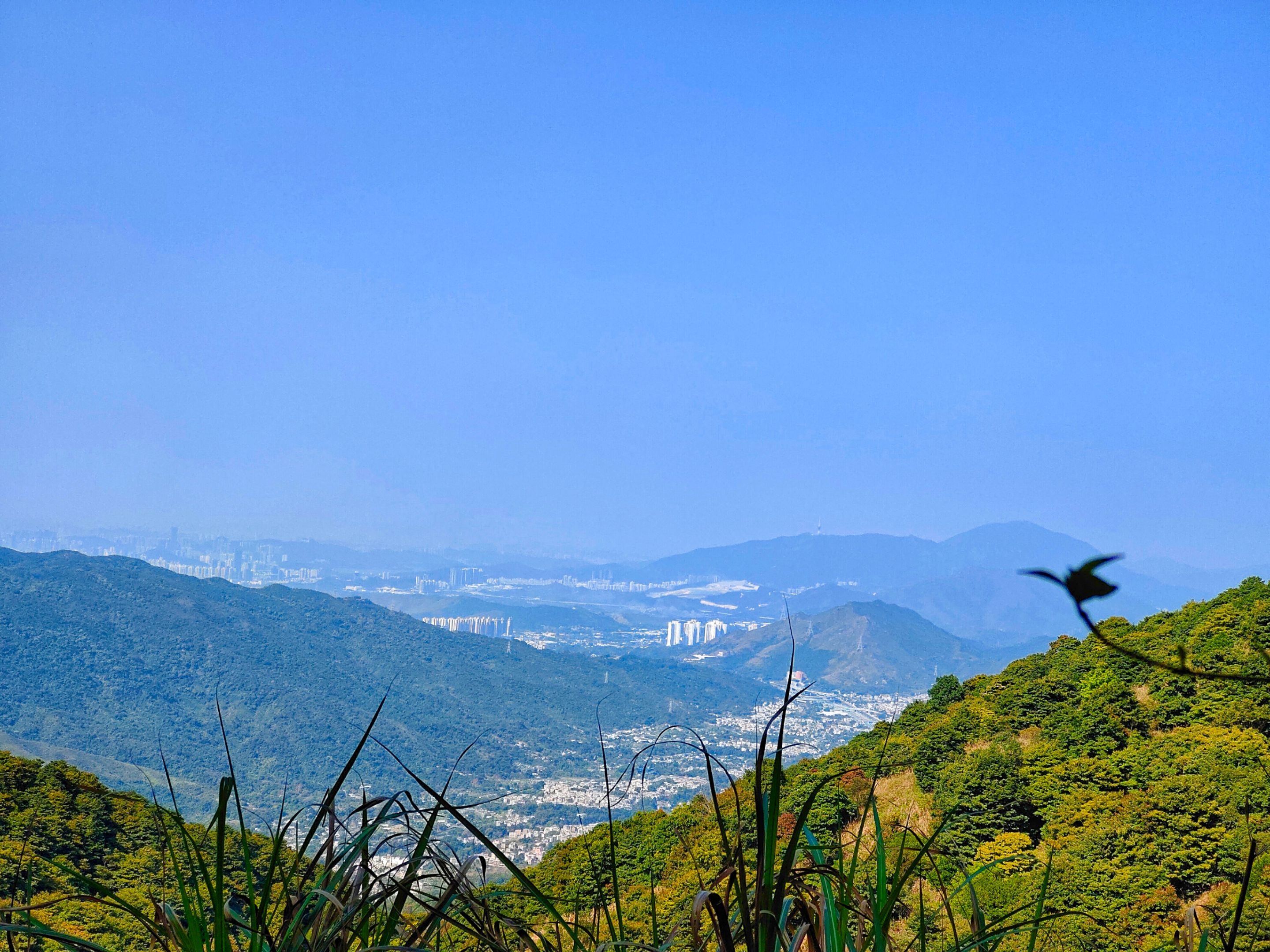
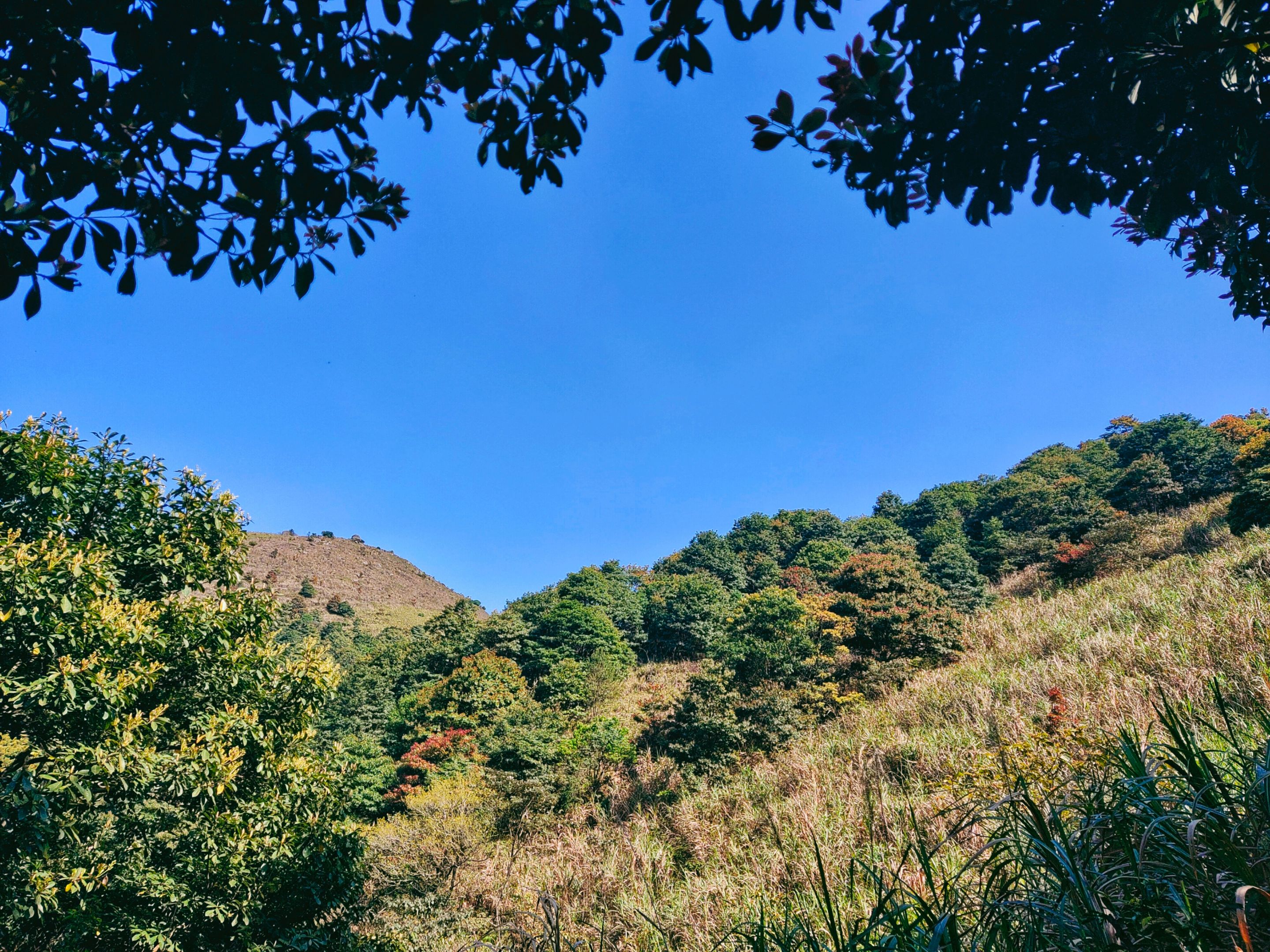
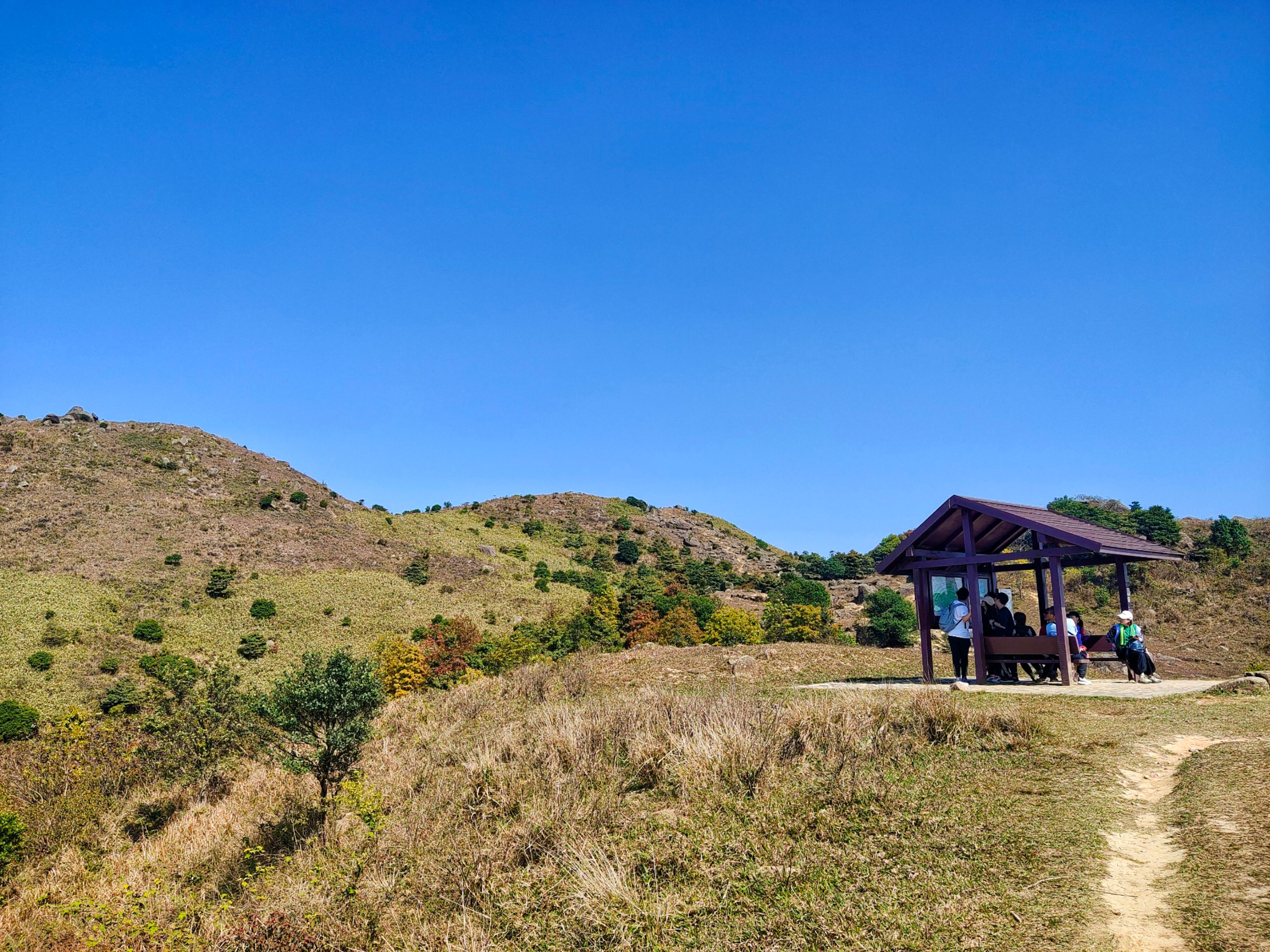
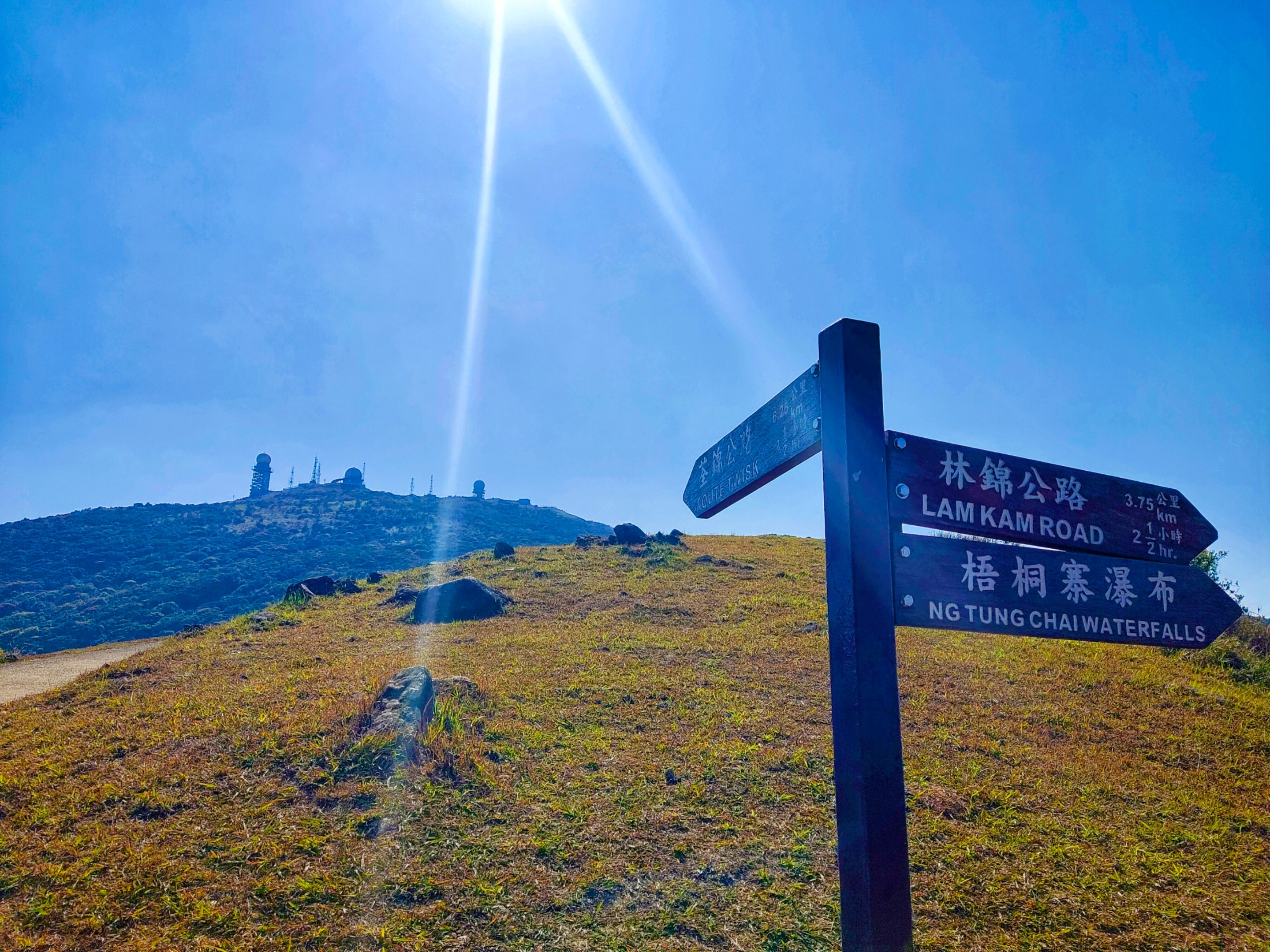
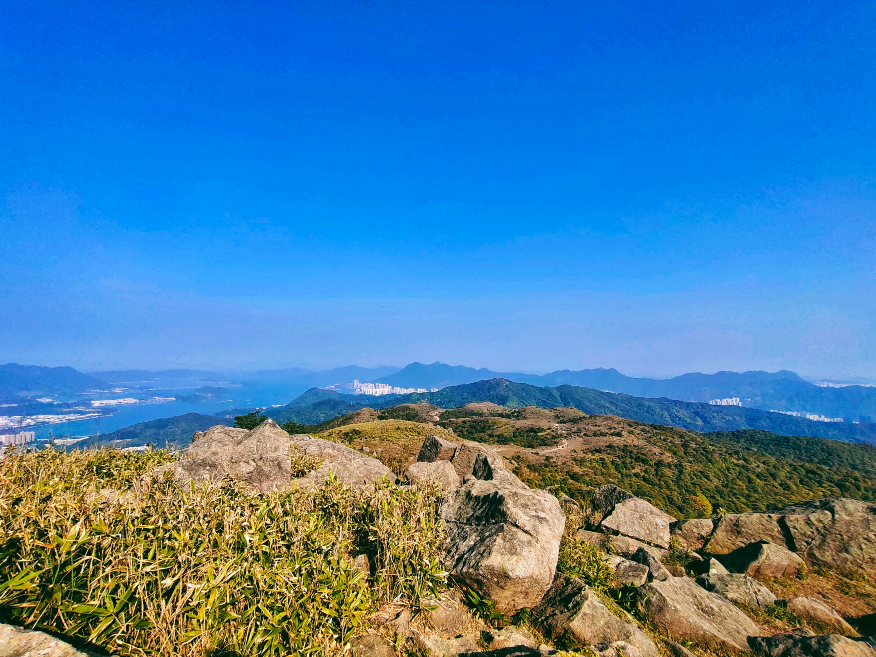
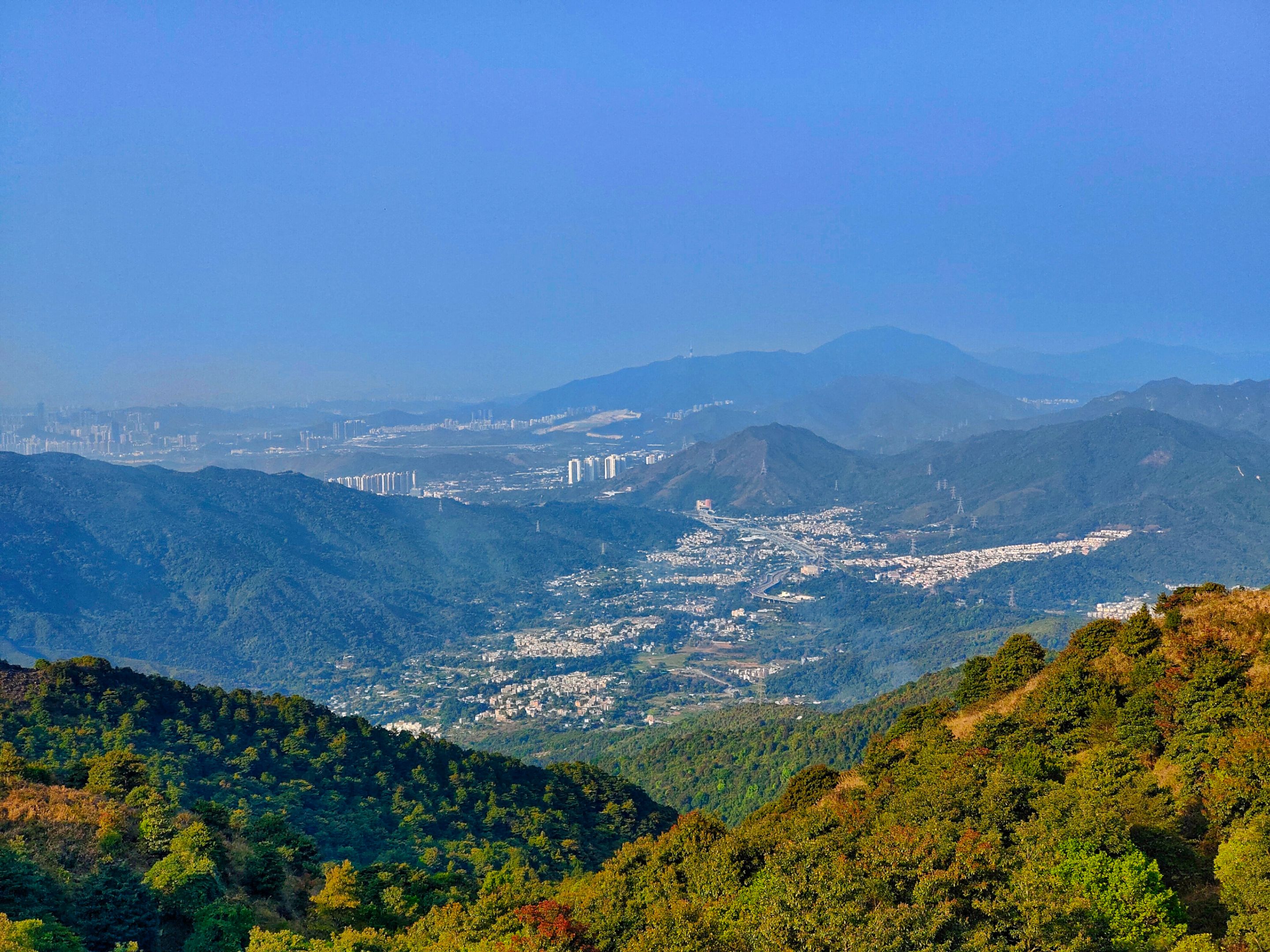
It was an indication that I was almost near the summit. Was I? Just keep reading to find it out. At three in the afternoon, I reached this area with a resting shade and intersections to other trails. On the left was a mountain that I initially thought was the Tai Mo Shan Peak.
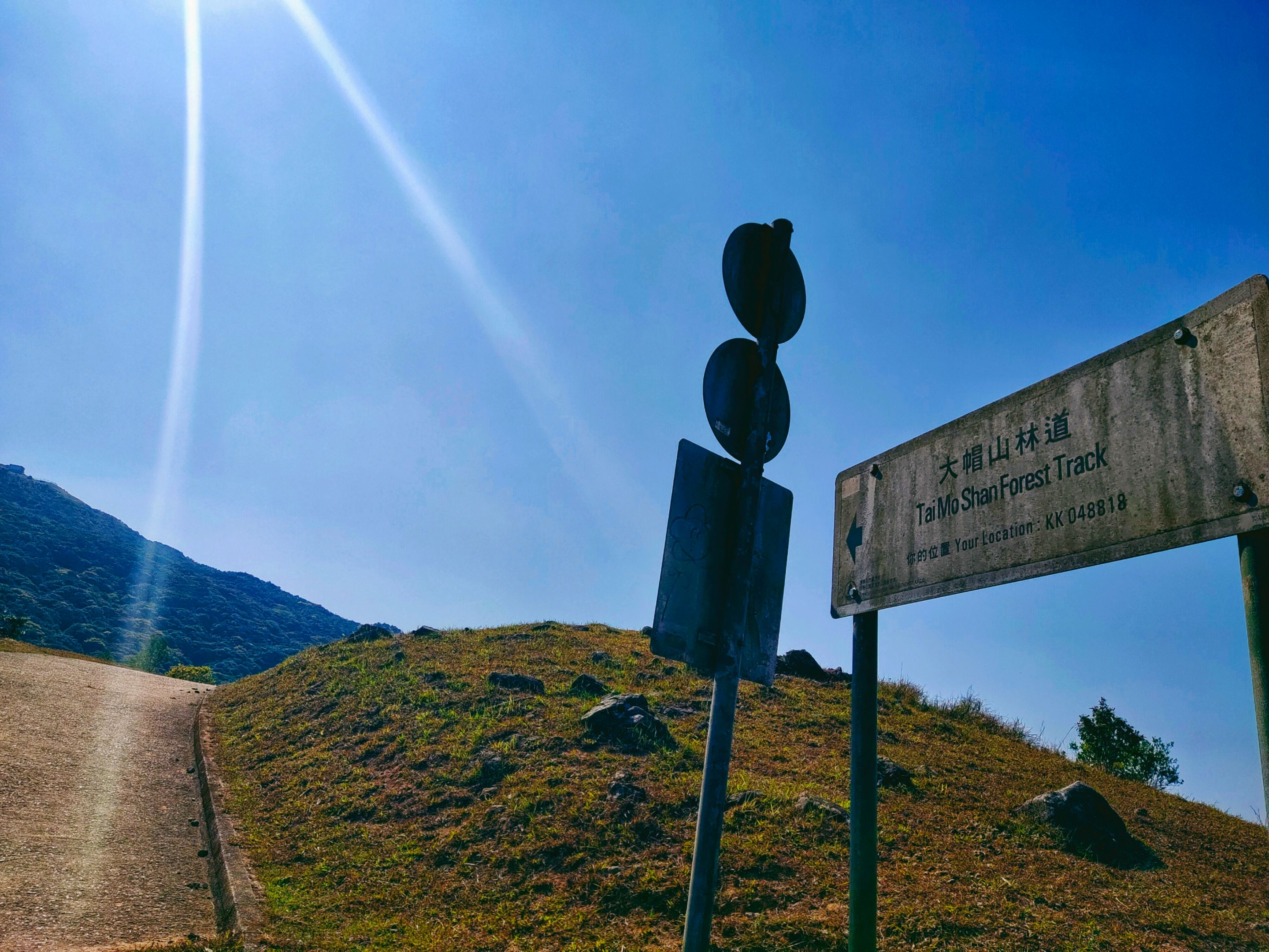
However, upon checking the direction posts, a sign shows Route Twisk which is 1½ hours ahead, and the Tai Mo Shan Forest Track. That alone shows that the mountain on the right was the Tai Mo Shan. And it, therefore, shows that I was still quite far from the peak. Imagine the three hours journey in the jungle! And I was still far from the real peak.
 |  |
|---|
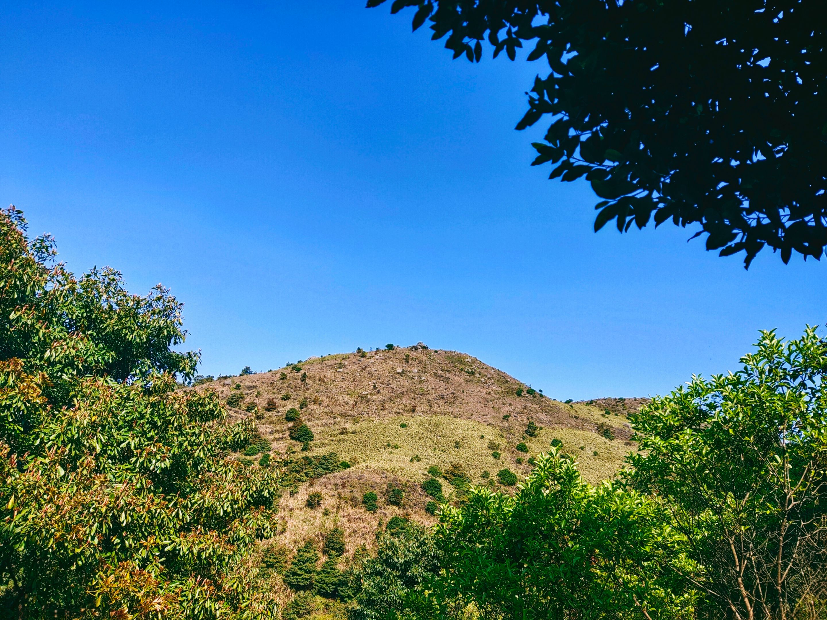
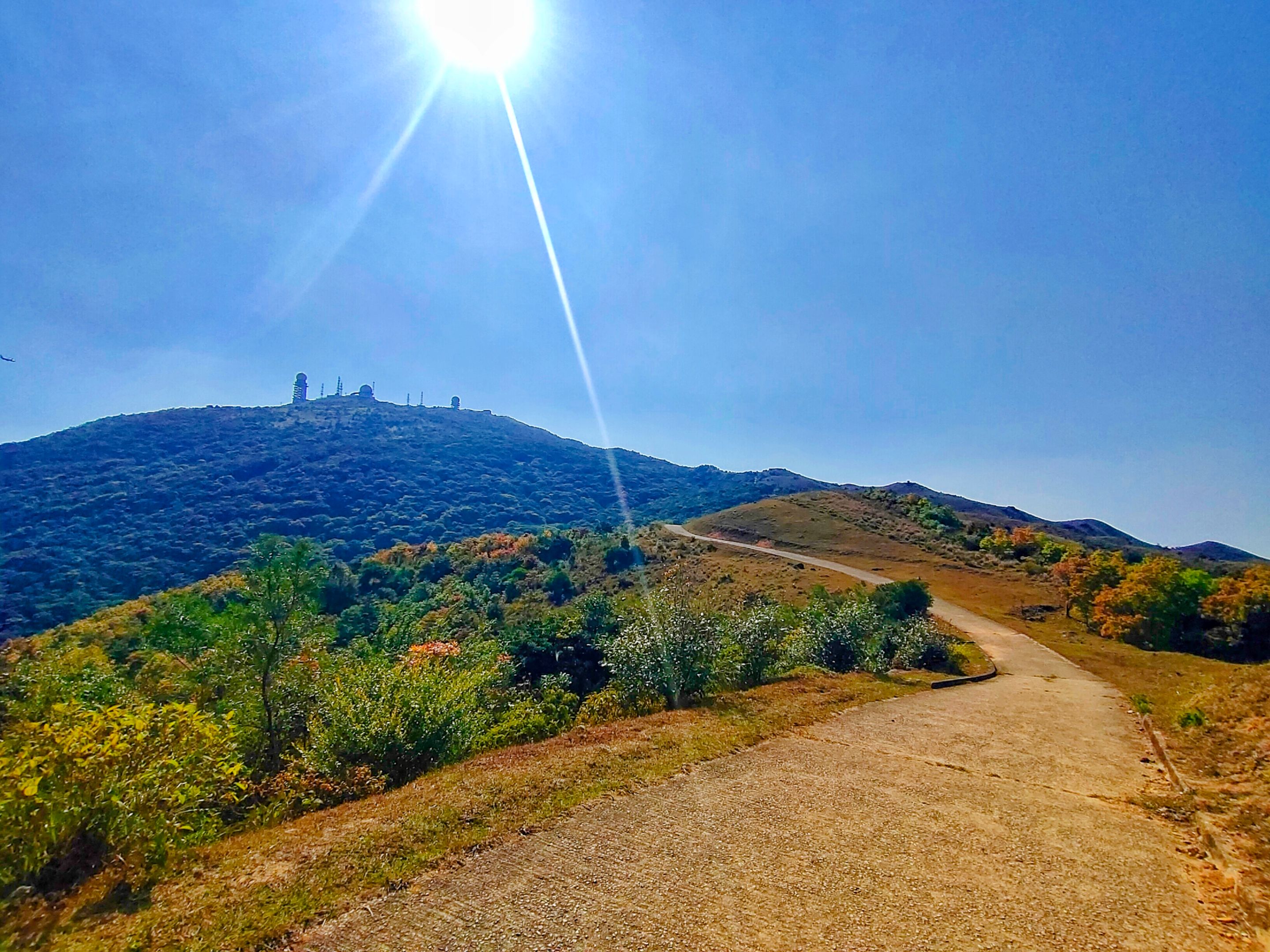
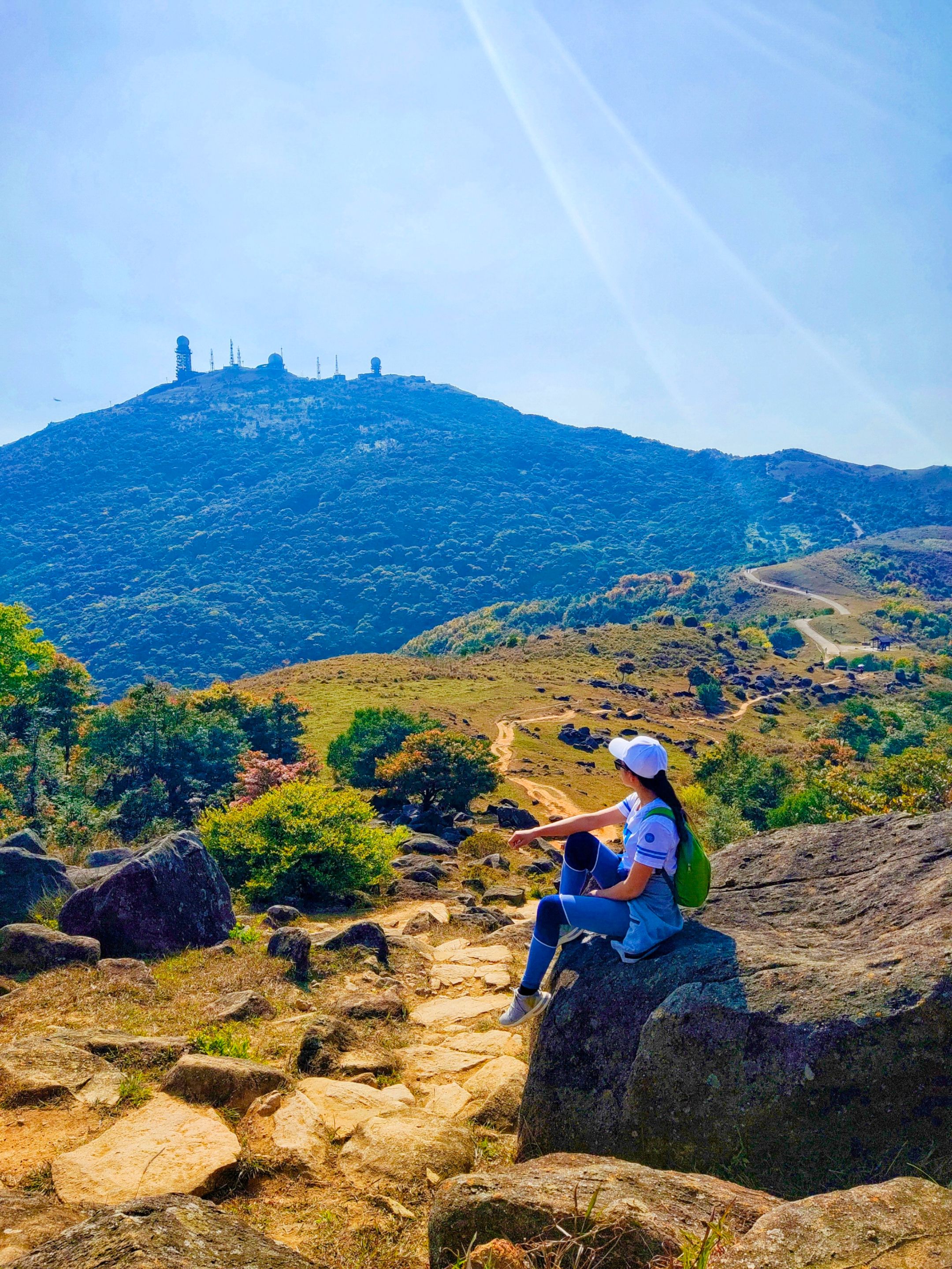
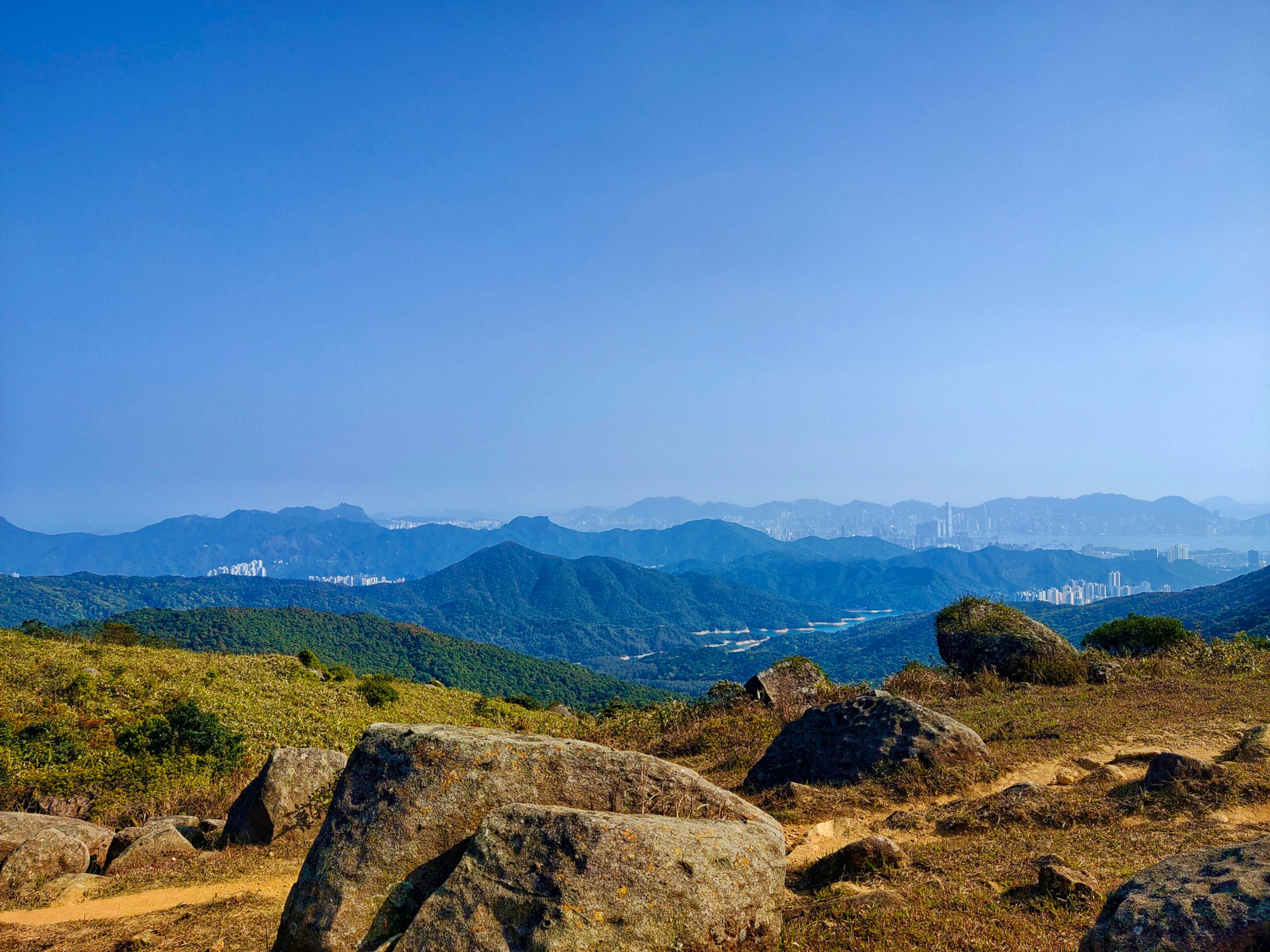
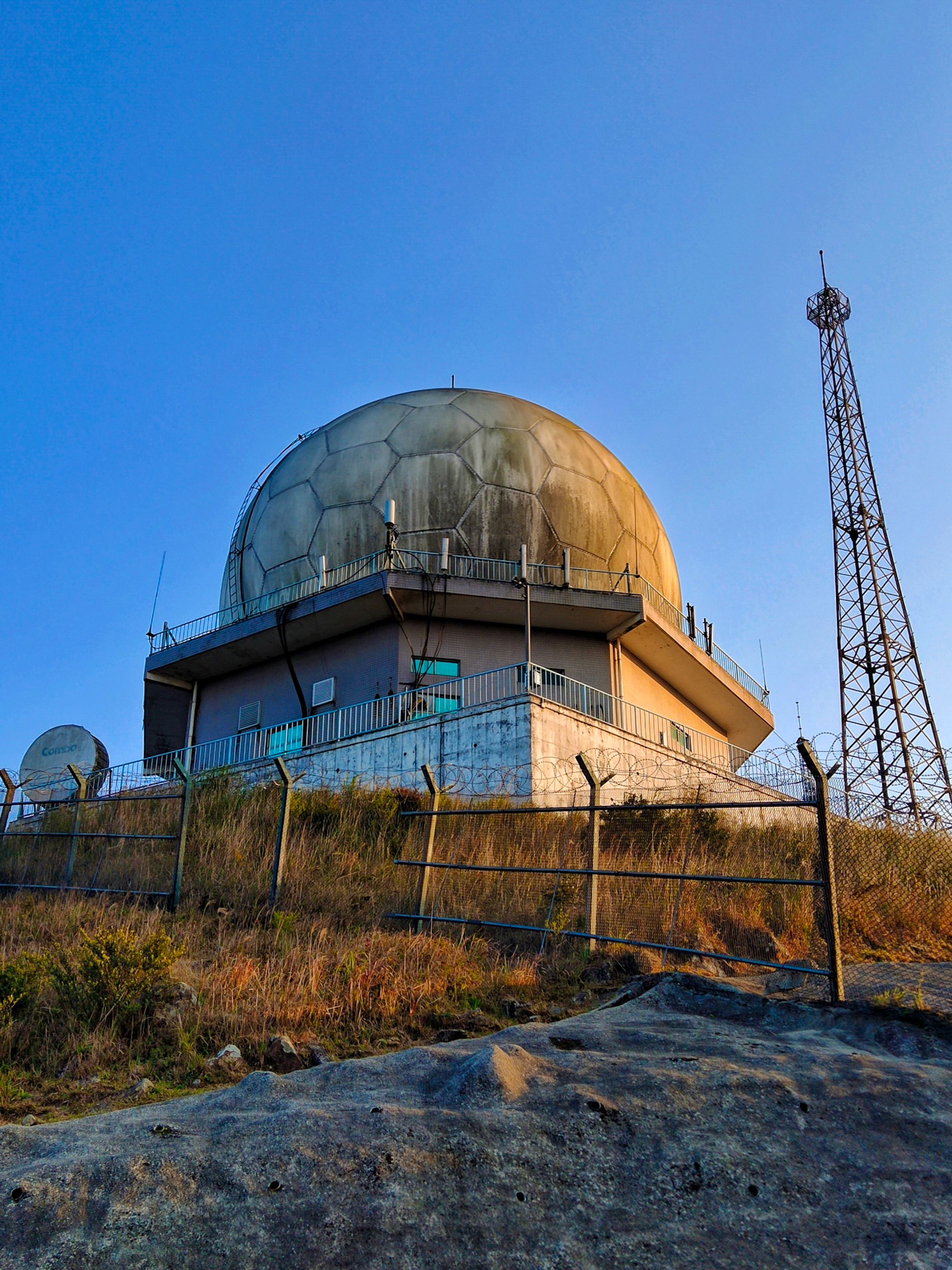
From the distance, I was seeing another mountain which could possibly be the summit, and the Weather Radar Station on top. I was certain about this radar station as I saw photos of it online. However, I was uncertain if the mountain was the real Tai Mo Shan peak. It looks near right? The hell not!
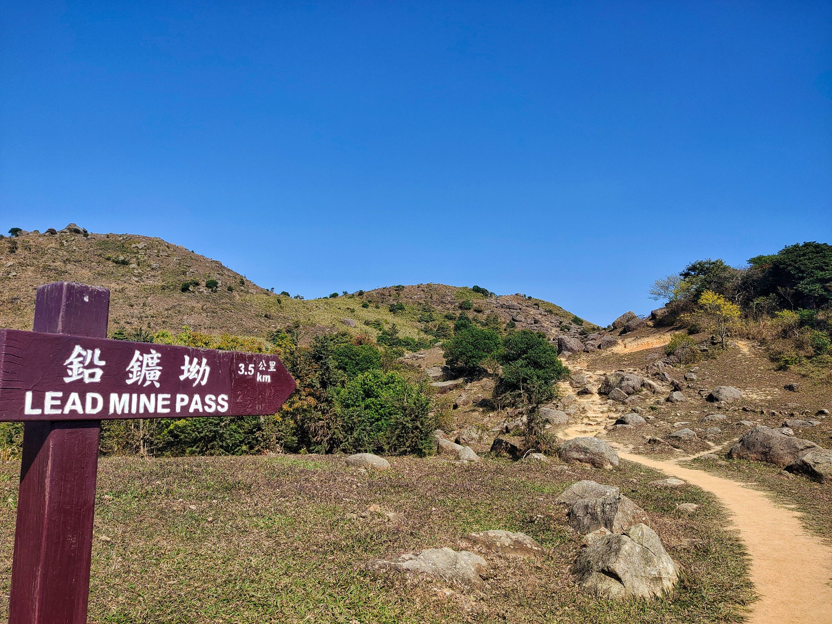
I was in the middle of two mountains and was uncertain which one is the real peak I desired to reach. I visually measured their heights to see which one was the highest. To prove my thoughts, I intentionally visited the left mountain before going to the right mountain. The left one lead me to Lead Mine Pass.
Reaching two peaks in one day
(continue reading to find out how I reached two peaks in one day)
Surprisingly, the Lead Mine Pass is another mountain located in the middle of Tai Mo Shan and Grassy Hill, so it proved that the mountain on the right side was the Tai Mo Shan. Since I was already on this trail, I decided to continue.
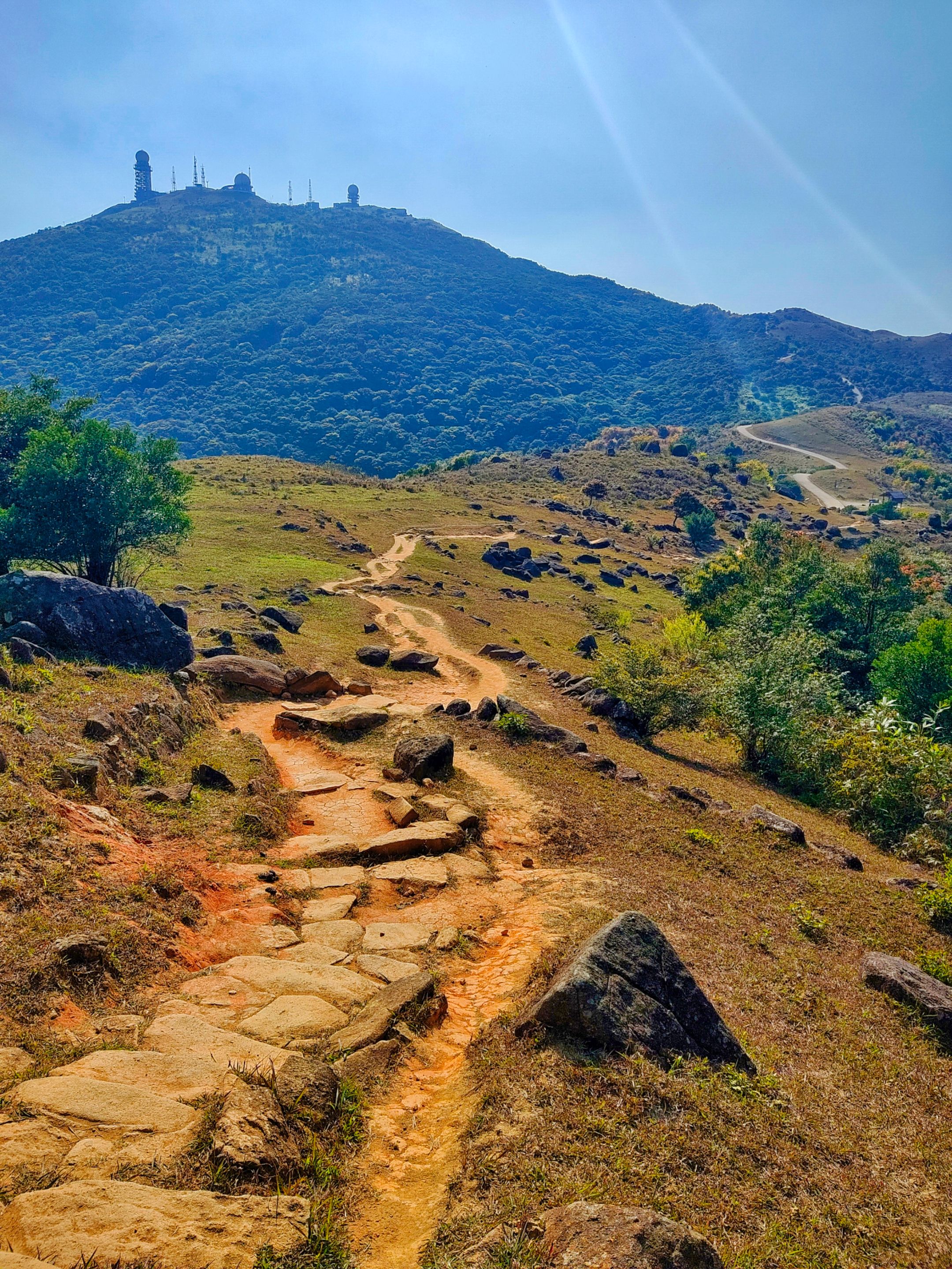
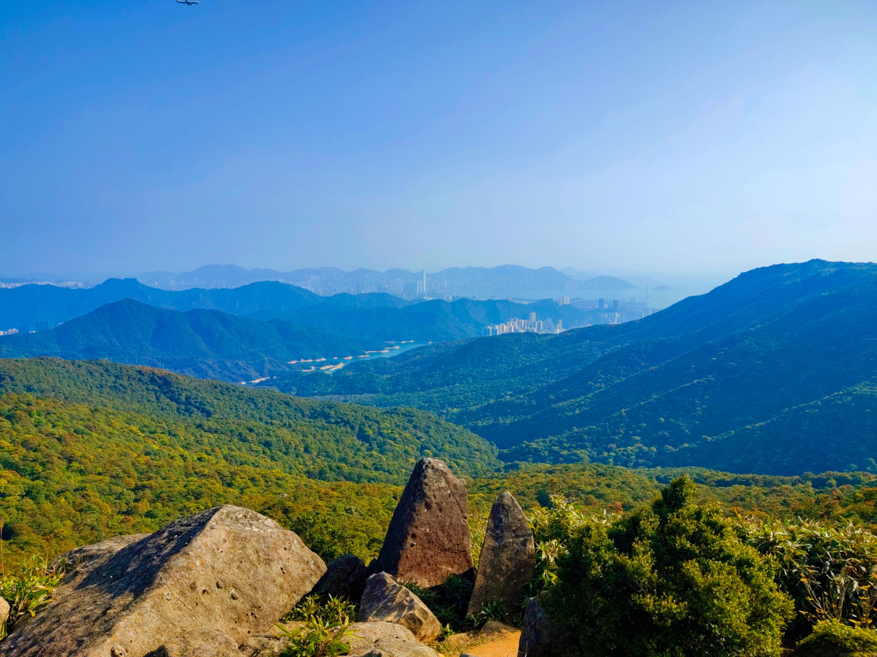
I was looking at the distant mountain and asking myself, "What time will I reach that peak?" By the time I reached this spot, it was around 3:30 in the afternoon. The view of the winding trails and the highest peak is beautiful, isn't it?
The Lead Mine Pass is a rocky mountain and from the name itself, you could tell that there was a mining area in this place. If not existing in the current era, probably in the past. More hikers were coming from this mountain and probably going to the opposite mountain.
The pineapple dam in Shing Mun Reservoir and the Needle Hill I climbed before are visible atop the hill.
You can check my separate blog about the Lead Mine Pass here to see more photos atop the peak.
Still smiling here even though I was already exhausted due to the steep trails, lol. Who wouldn't be relieved by this stunning view, anyway?
The final stretch
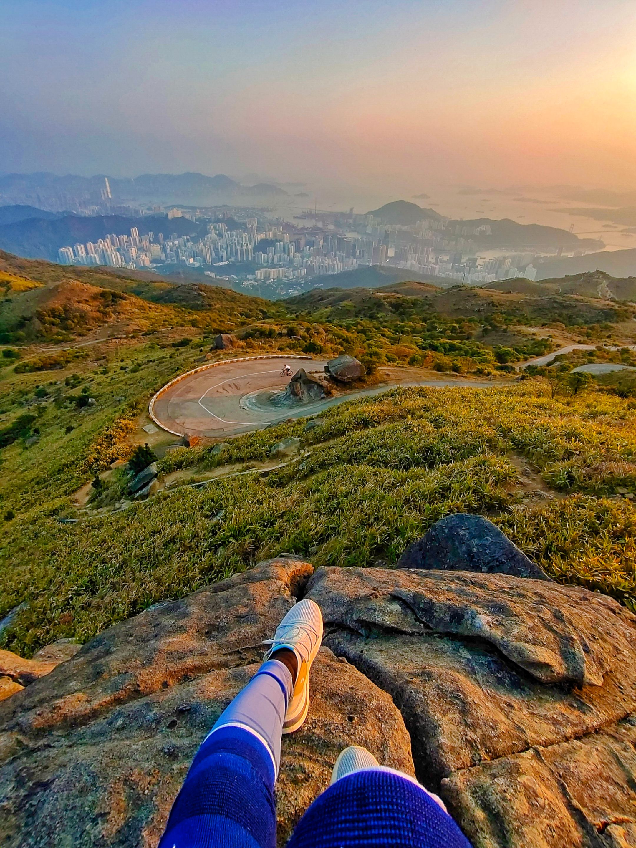
The sun was slowly settling so I have to go down back to the resting shade and start another journey to the highest peak. I zoomed this view out to check the trails and I just felt exhausted upon seeing it.
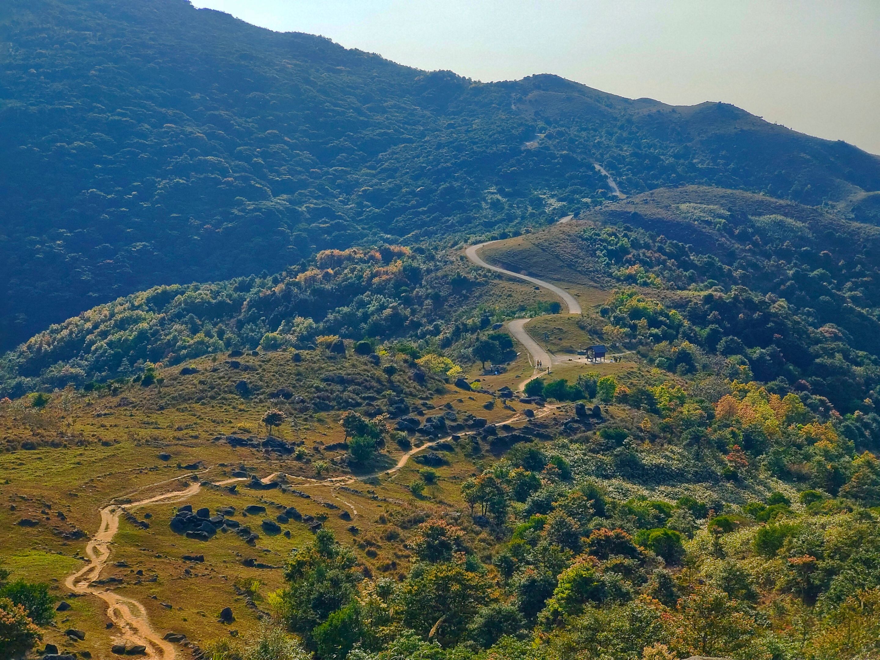
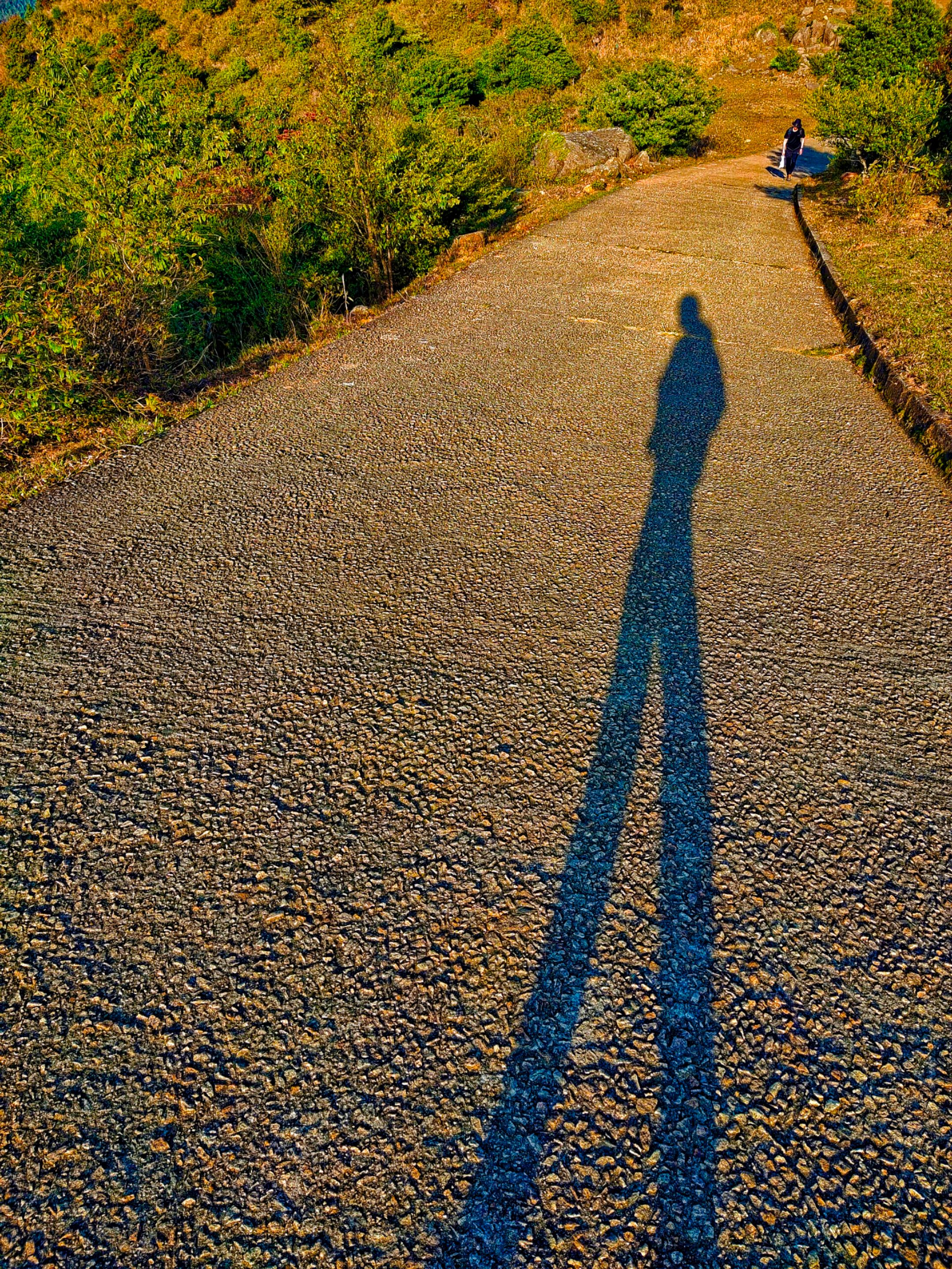
It took another thirty minutes to go back to the starting point (direction post) and I saw this group of teen students going up the trail so I followed them. At least, I wouldn't be alone.
The long stretching trail is paved making it easier to climb. However, it became steeper and steeper as I climbed higher.
I was checking the views on the right side from time to time and my right leg muscles suddenly cramped. This time, I truly rested as I felt like I was pushing myself too much and I couldn't bare to walk well farther. Moreover, I felt hungry so I took my chocolate wafers out to have a bite. I stayed until my legs got better and continued my journey.
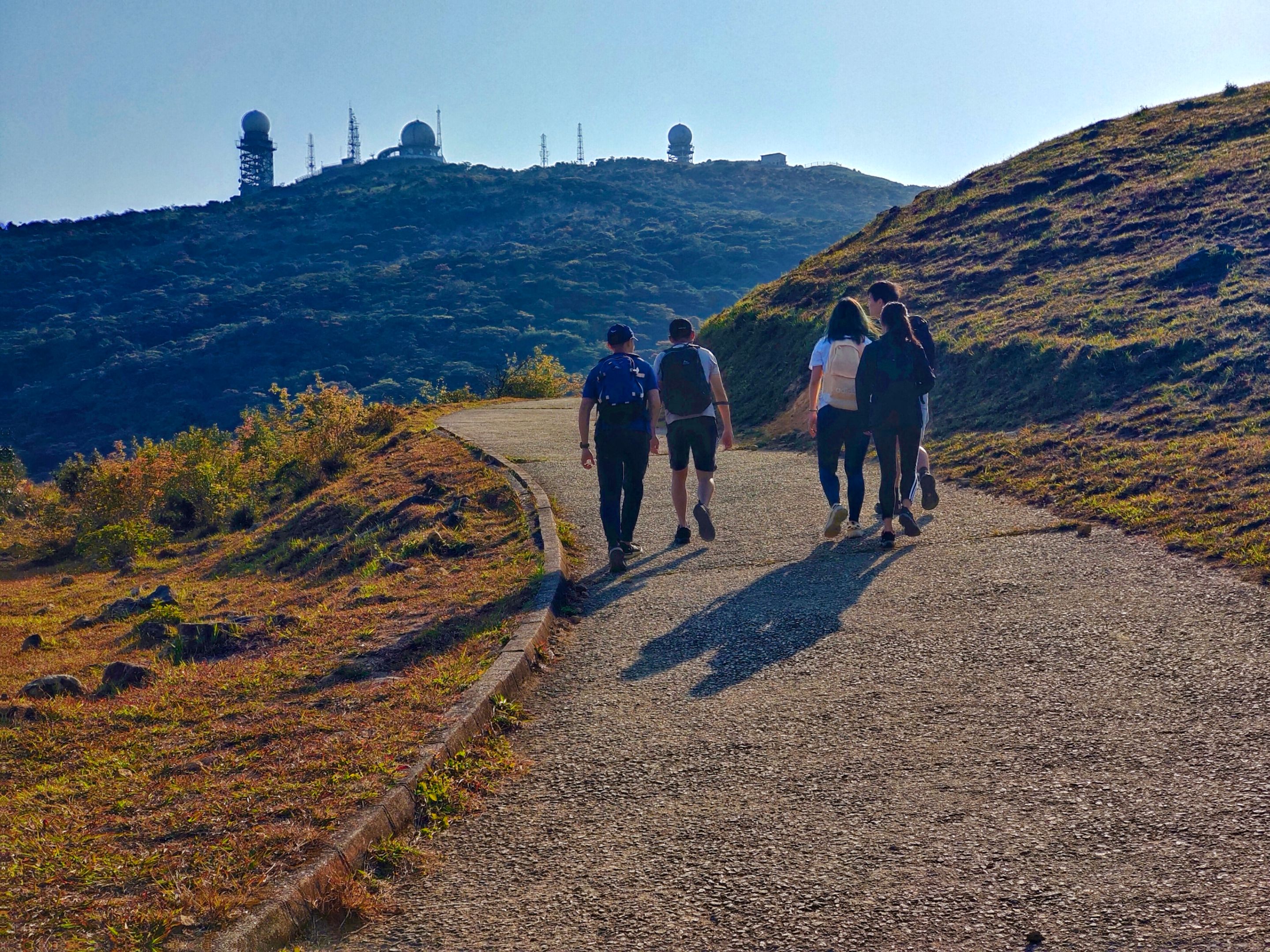
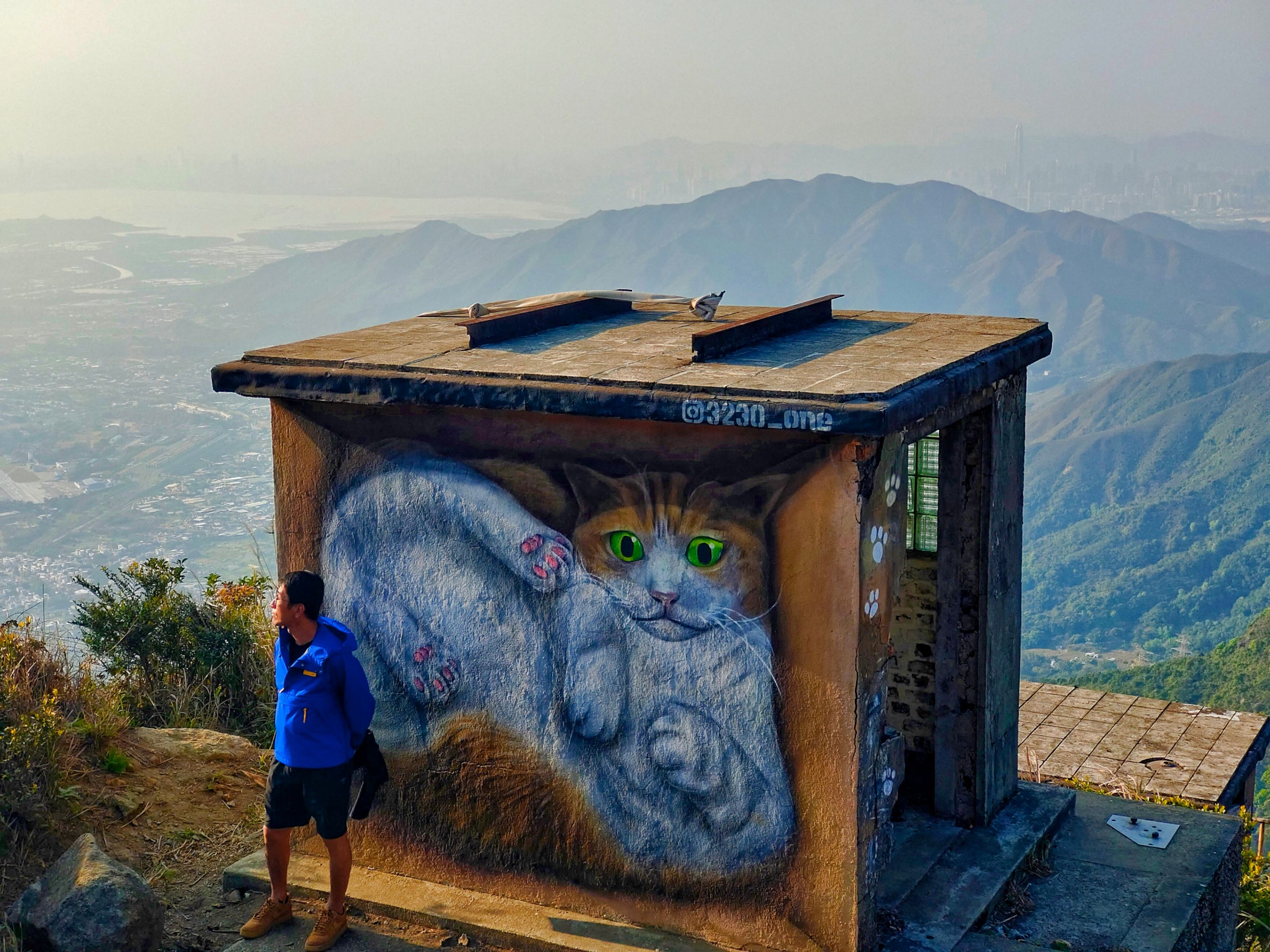
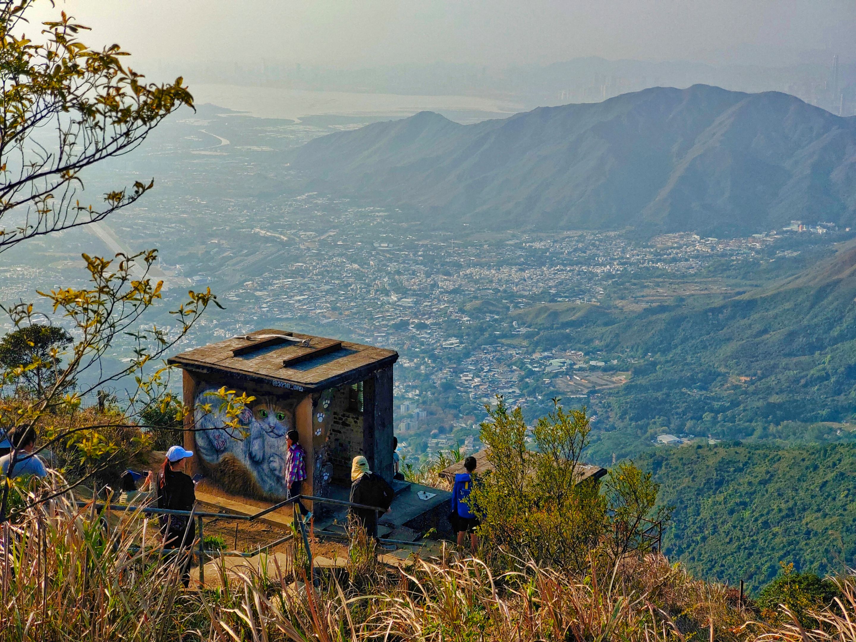
I felt hopeful upon seeing the radar station atop the peak getting nearer and nearer. Thus, I was also nearer the peak. Before taking the turning point to the radar station at around five in the afternoon, I stumbled upon this abandoned building nestling along the ridge.
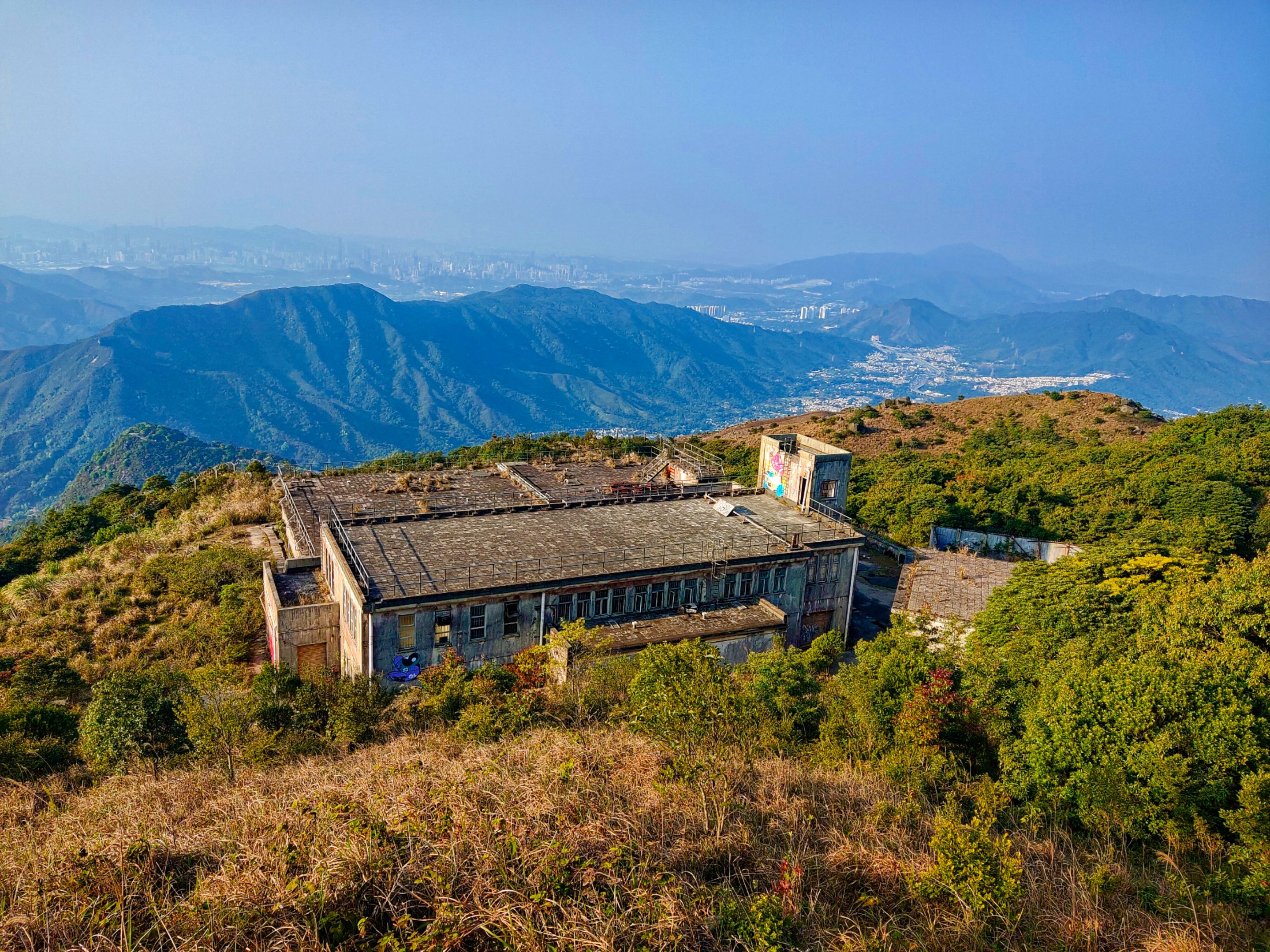
There were hikers along the stairs and some were resting at the watch posts so I opted to go down. The cat mural on one of the watch posts was another attraction. After a while of contemplating whether to raid the abandoned building or not since I was solo, I gave it a try because I was a curious cat, lol.
You can read my blog about my exploration of this abandoned compound here. A short video was attached to give you a better view of the place. After exploring the derelict place, I left the area at past five in the afternoon and you can see the sun slowly settling below the horizon at my back.
The more I admire its beauty, the more I reminded myself to get myself faster as I might miss it on top of the highest peak. This spot below is a popular spot I saw in online photos. I wanted to get down to the rock formations but I had not enough time.
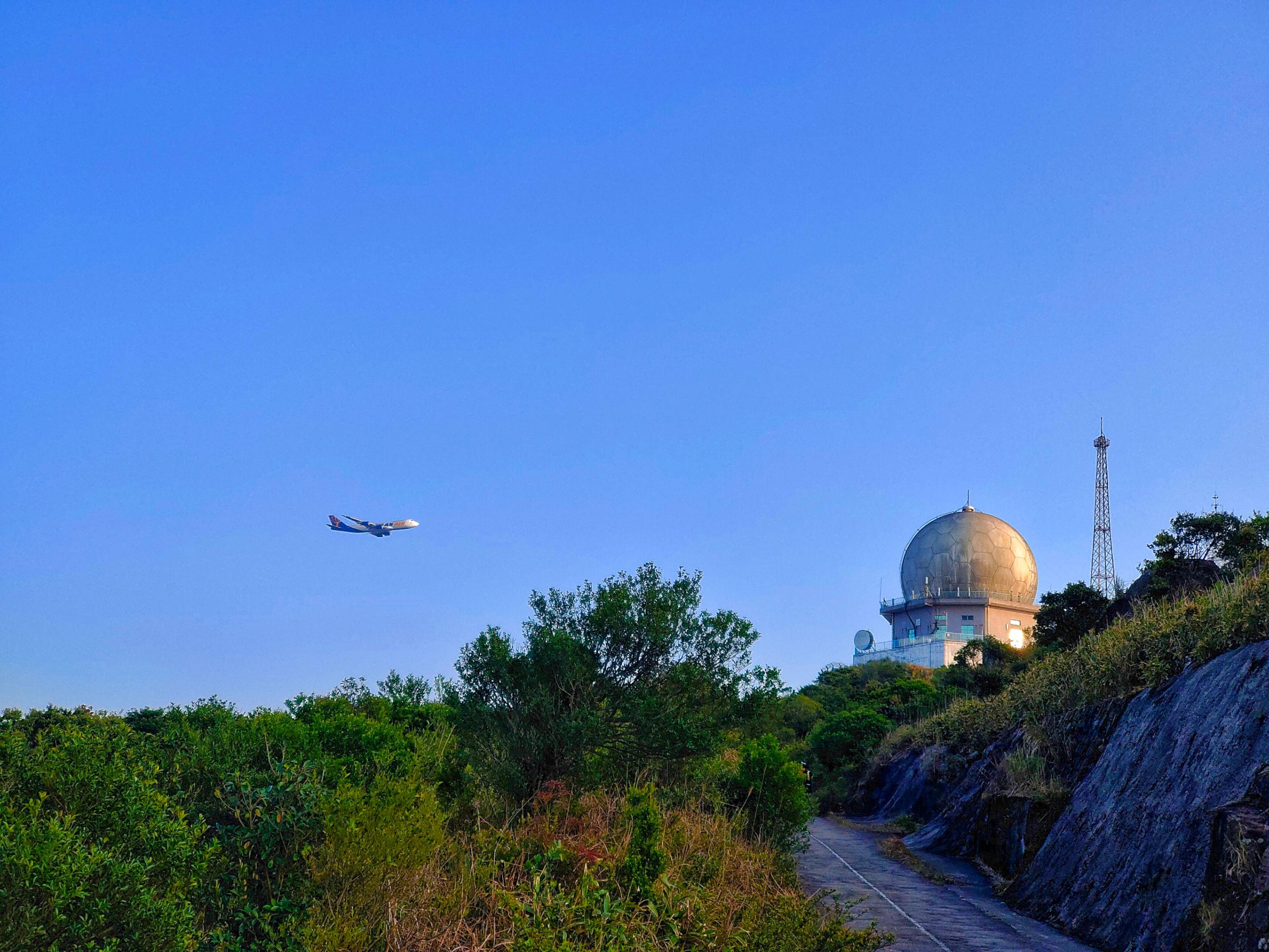
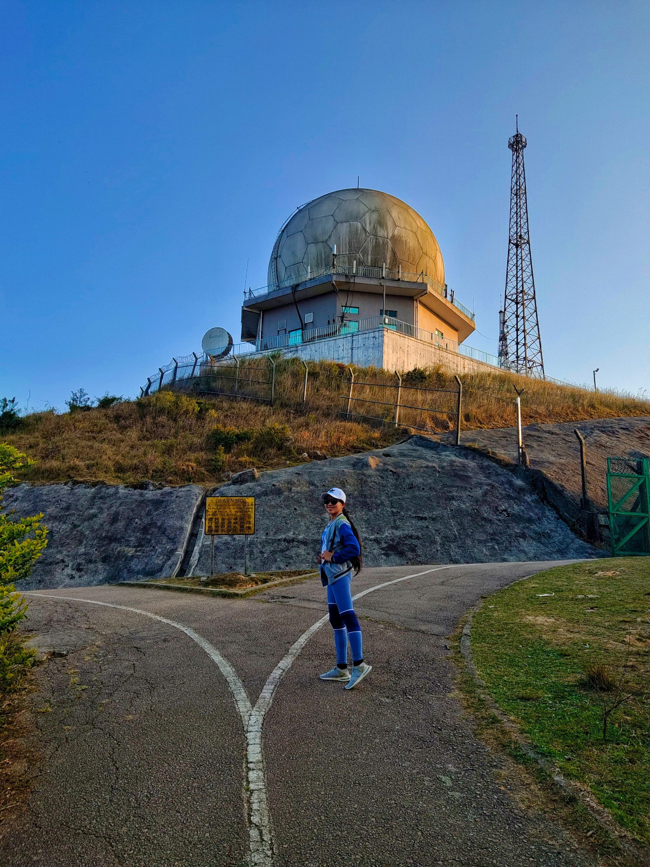
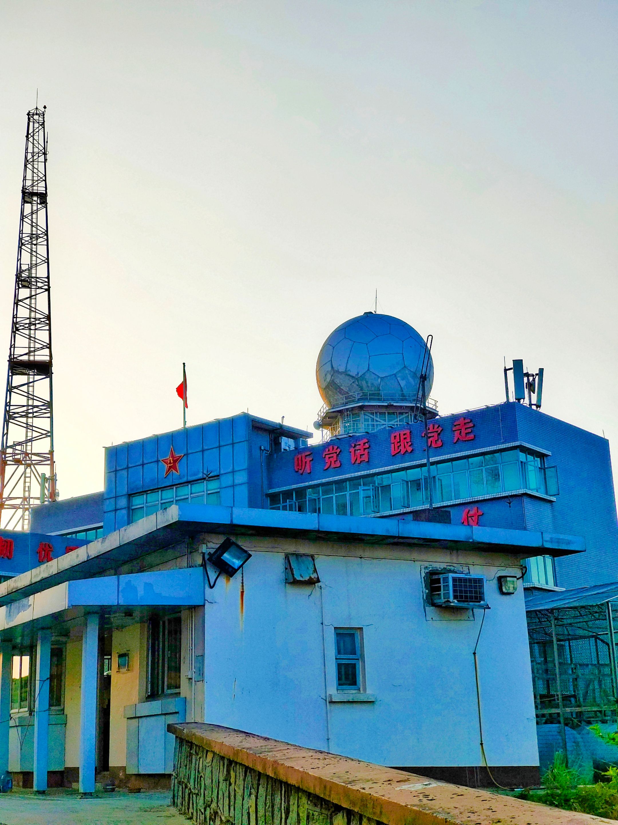
The photo below is the biggest Weather Radar Station in Hong Kong, and I felt excited as I got closer to it. Can you see the plane? Planes were passing by at scheduled hours and they looked too enormous in closer shots.
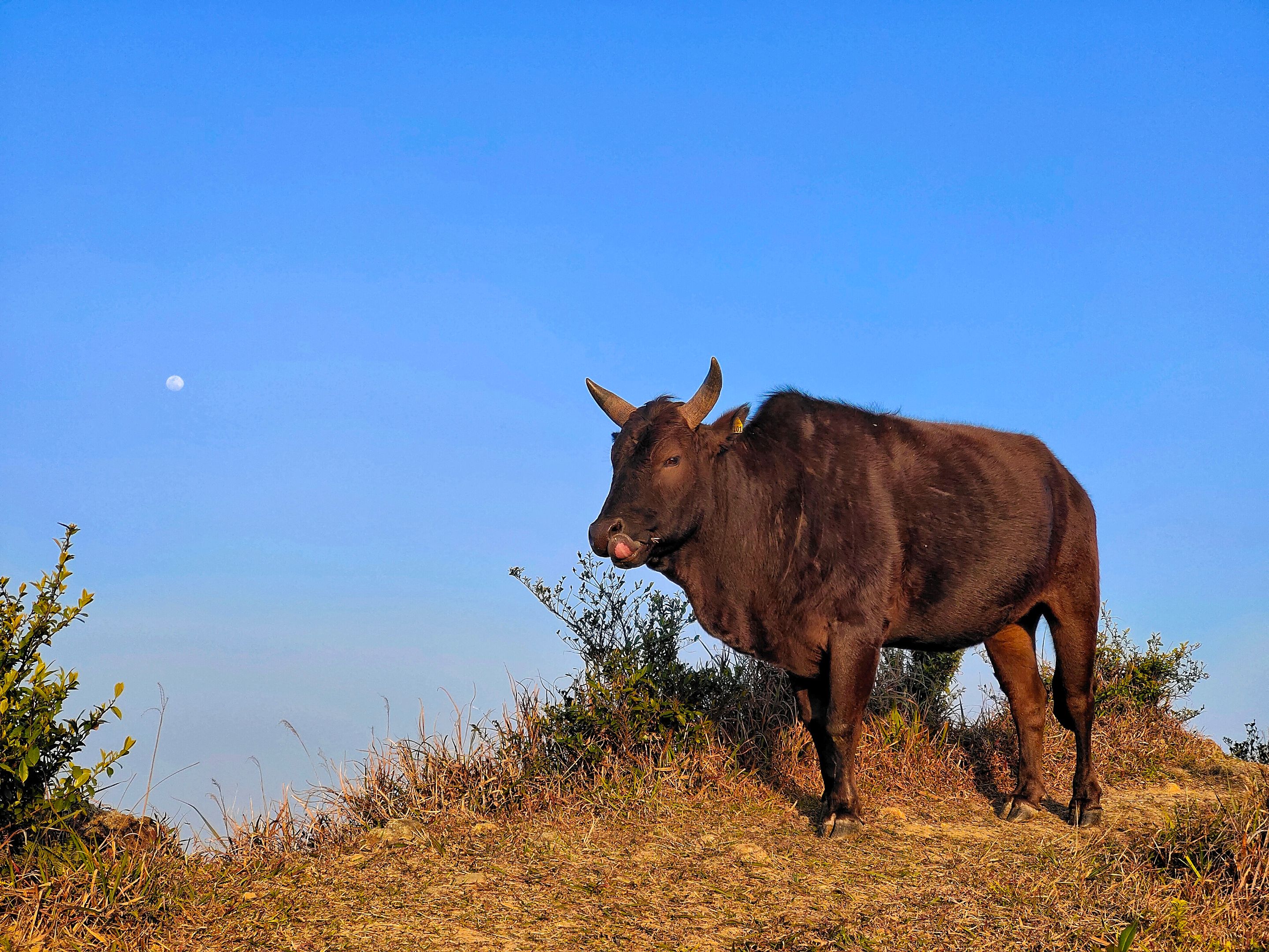
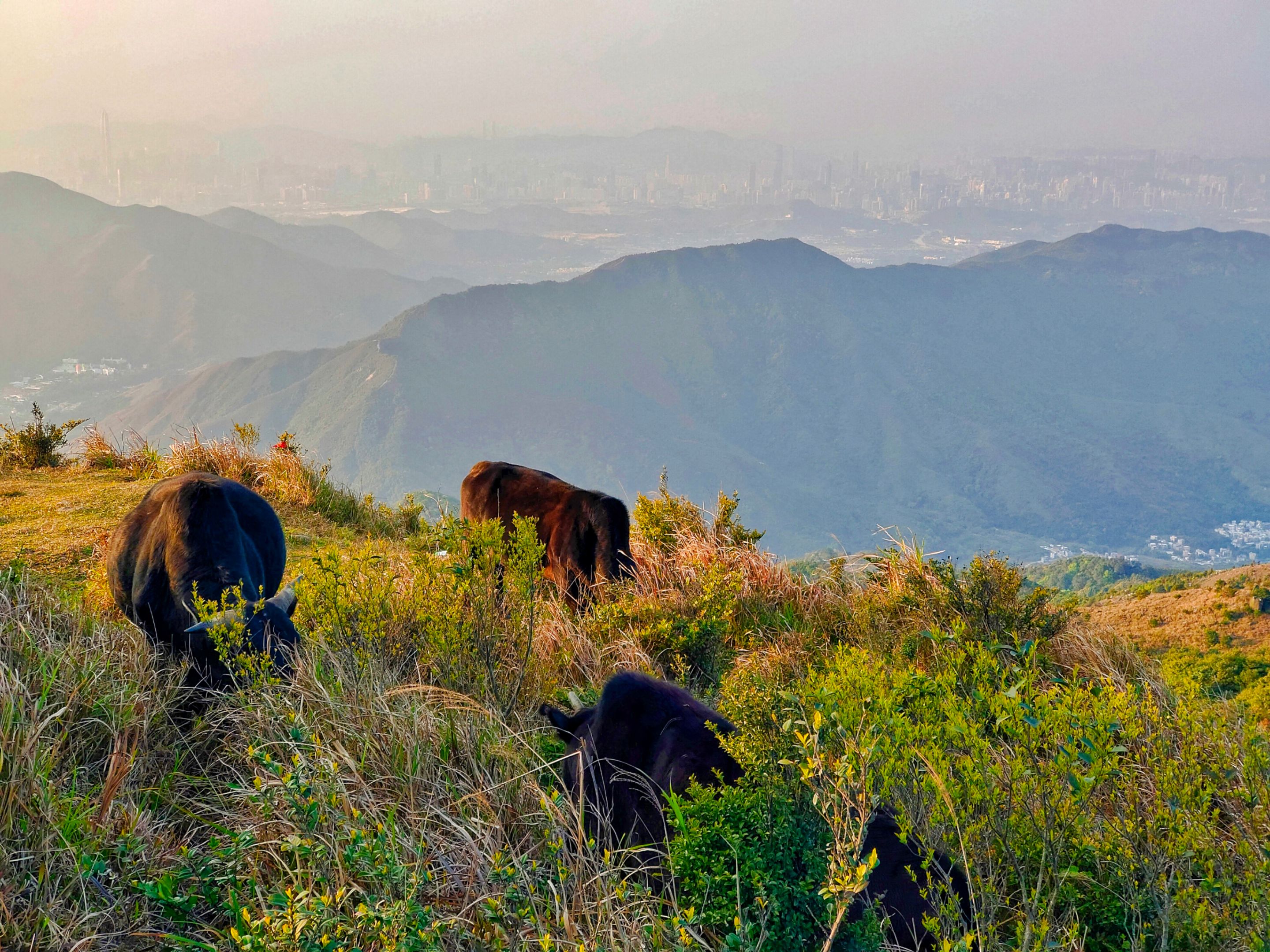
I came across cows resting atop the hill. That's when I realized that the scary sounds I heard when I was in the abandoned building that made me storm out came from them.
Did he just stick his tongue out at me? Naughty cow! The moon is already out. You can see it in the distance.
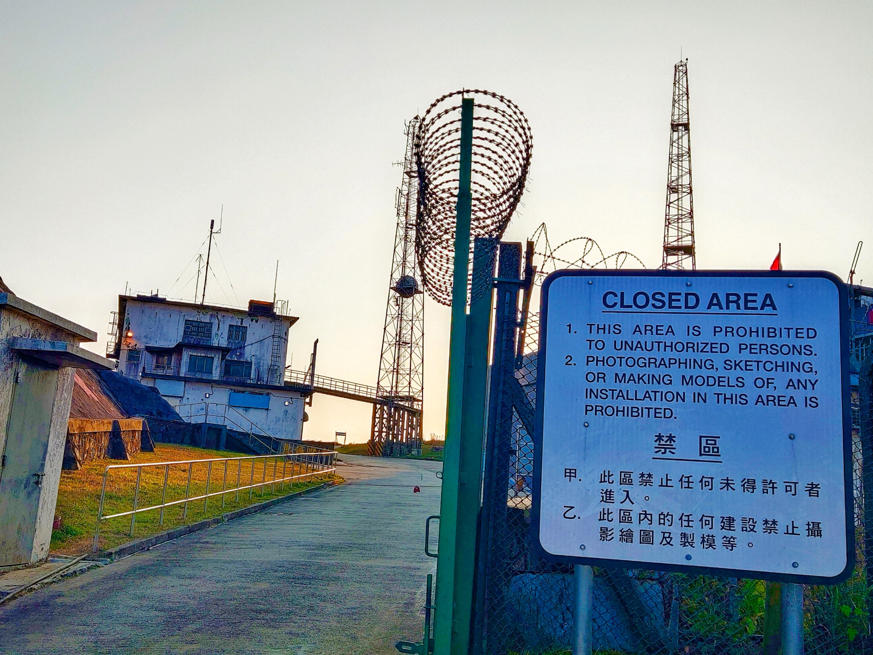
As I made my way farther, I came across an intersection below the radar station. The right way was leading to the inside part of the station. However, only authorized persons are allowed to go in.
 |  |
|---|
 |  |
|---|
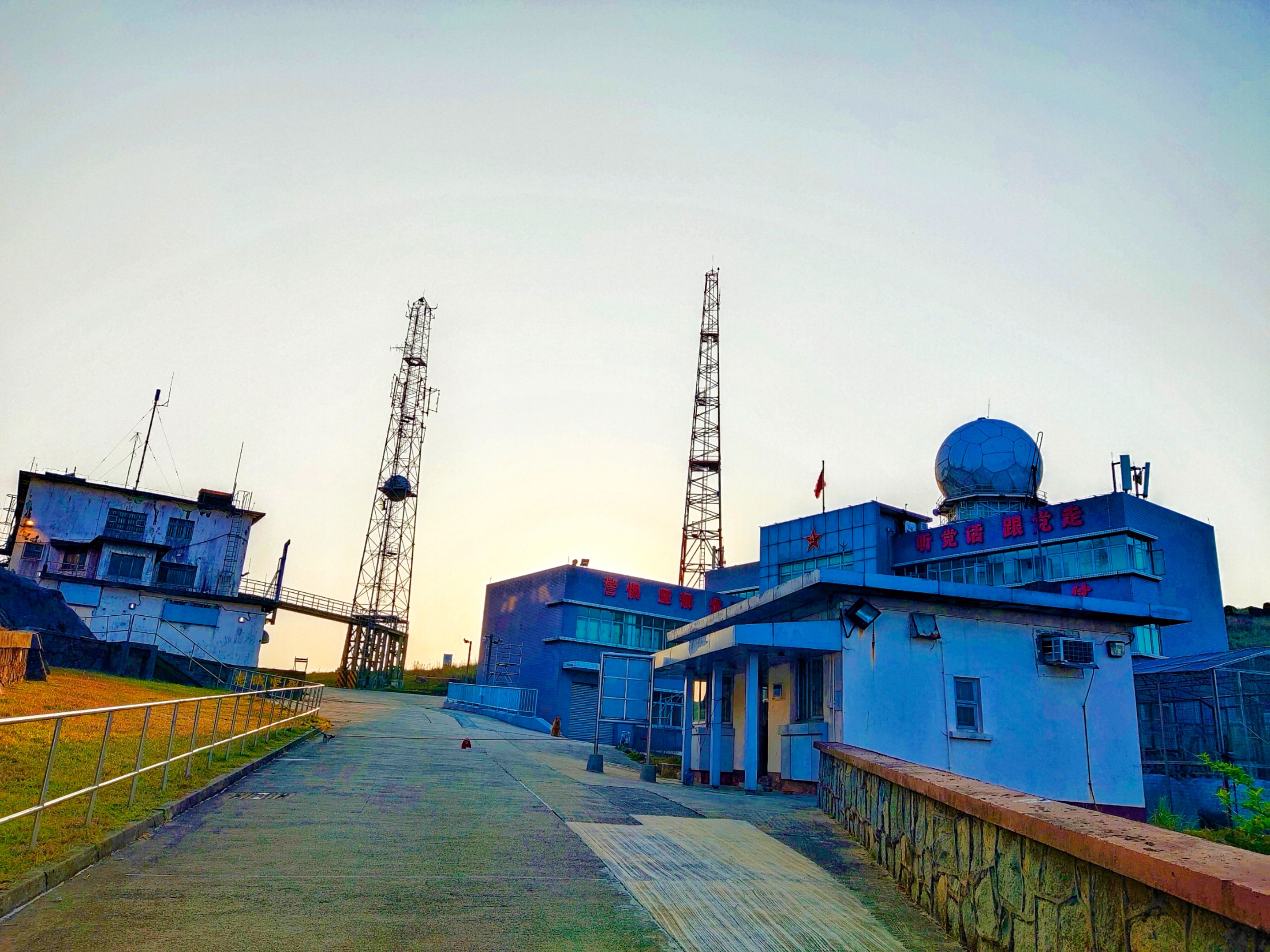
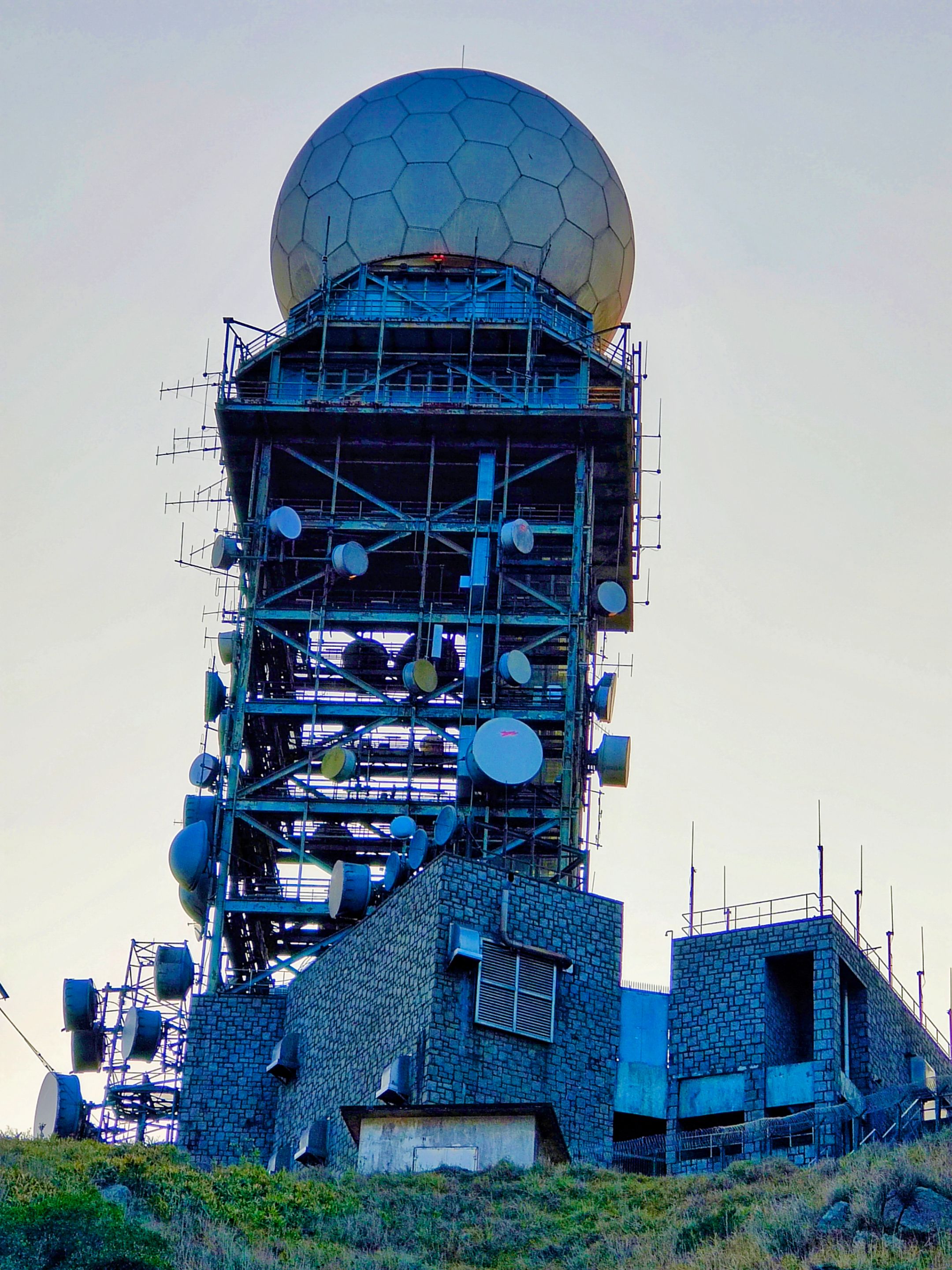
The view of the enormous radar from the opposite side.
I made my way to the left and I was more excited to see the other side of the peak.
This is where I came from, the Lead Mine Pass. The views got more stunning as I reached the higher part.
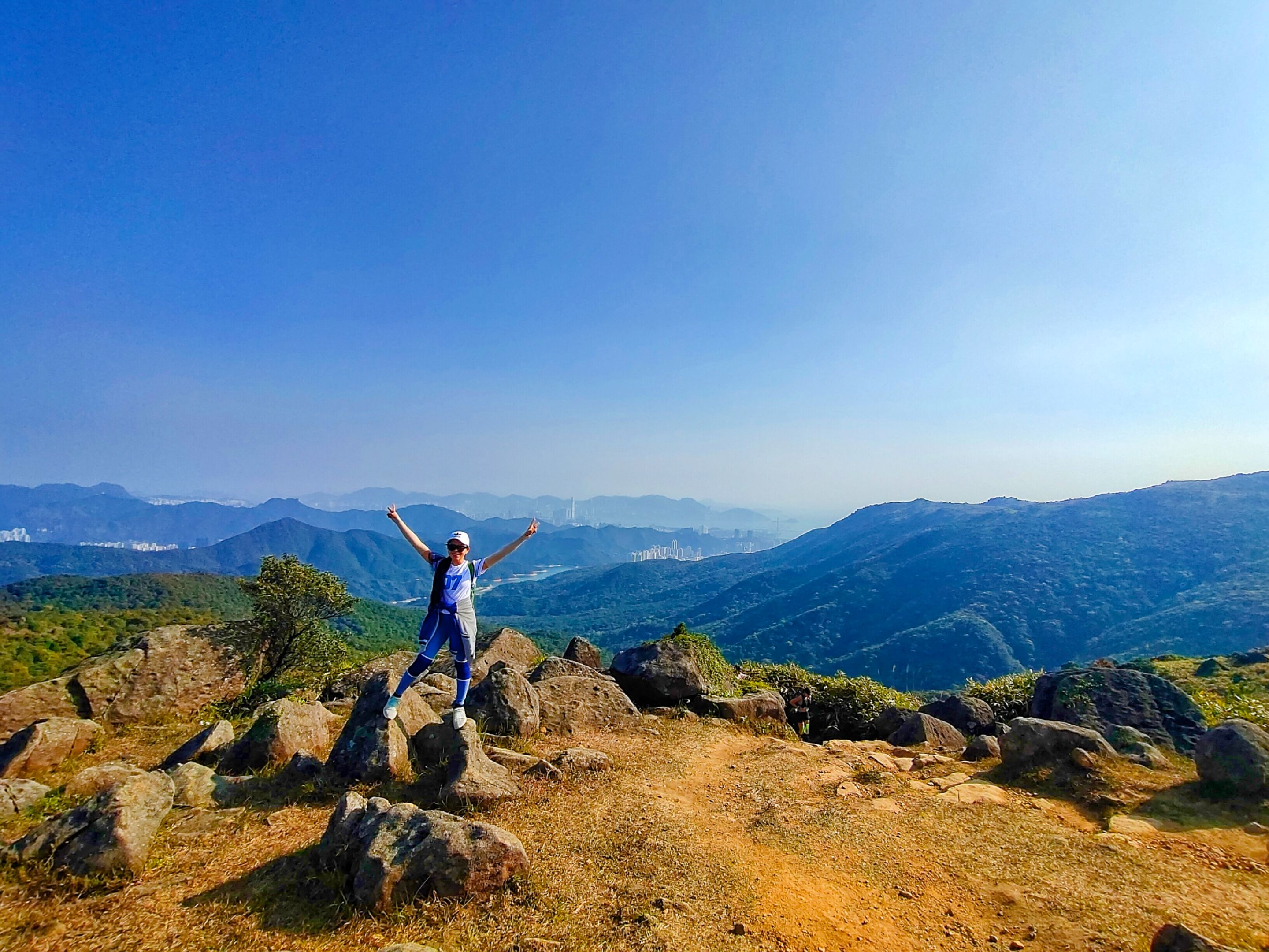
From the distance, I was seeing a group of people taking photos on a rock formation by the cliff. The spot seemed familiar to me (saw it in my article guide), and I ran to take photos by the cliff as well. With the help of some Chinese ladies, I got this beautiful shot.
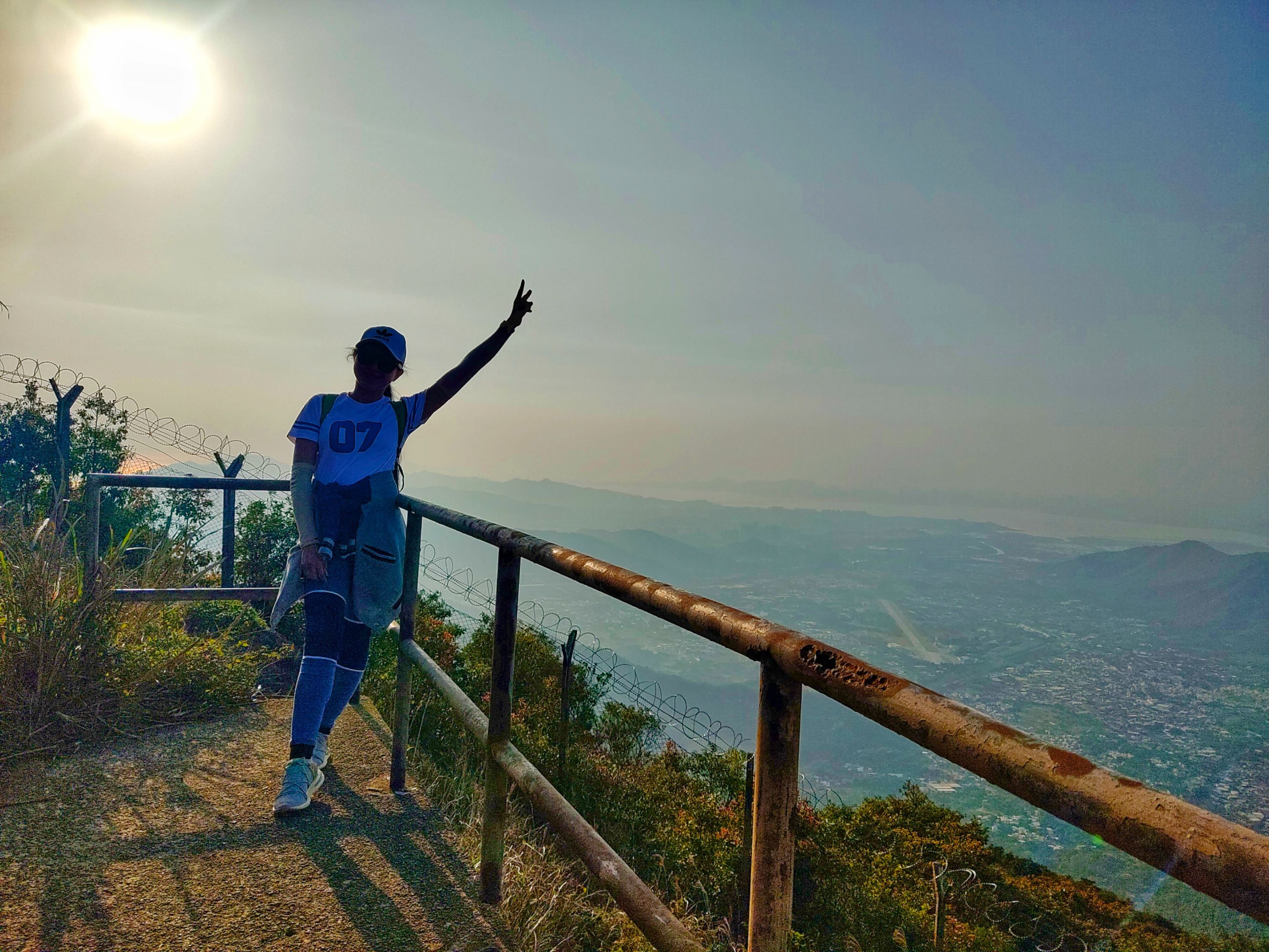
I'm on top of the world! No, on top of Hong Kong!
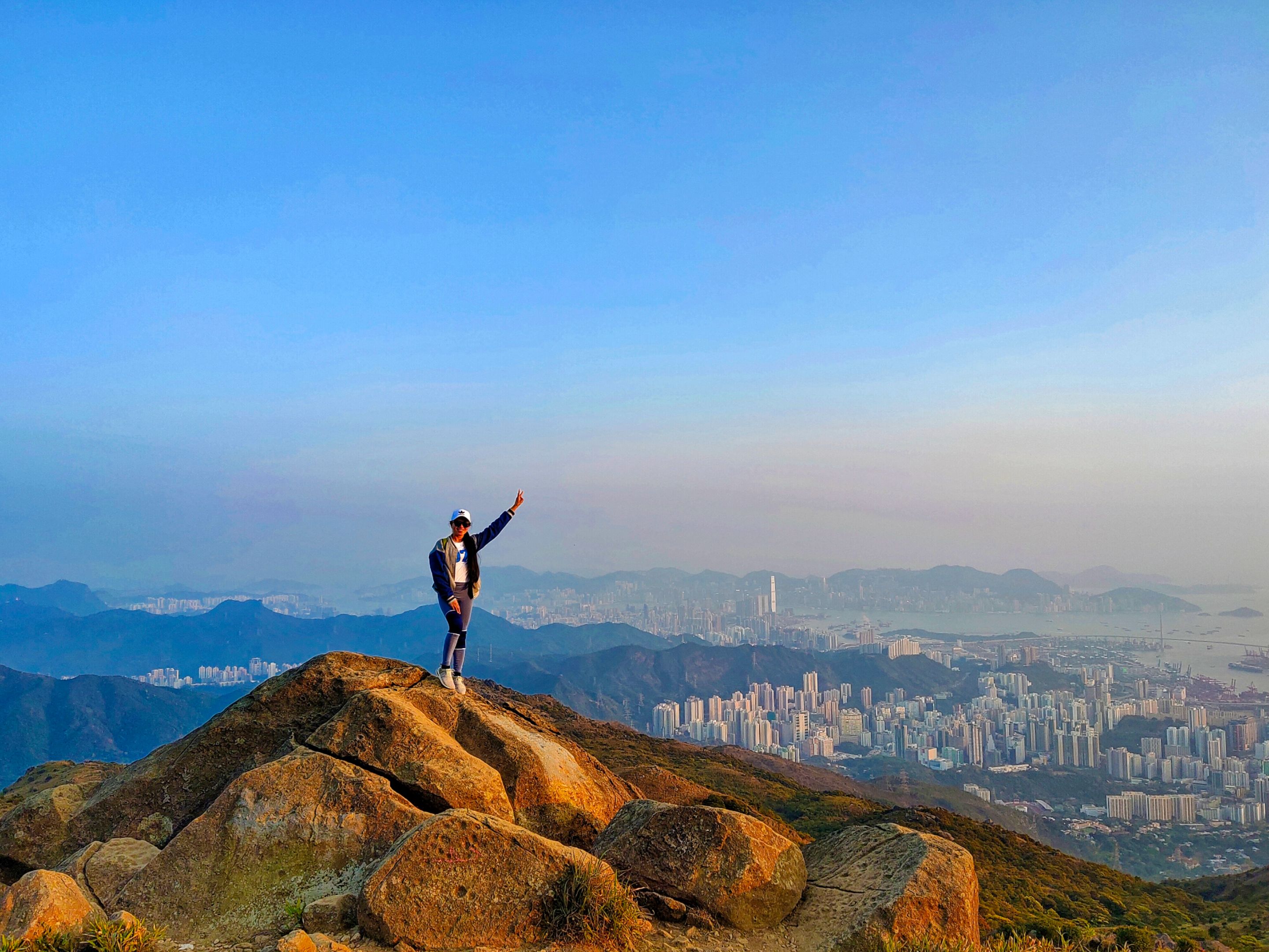
I took my phone from the Chinese lady and got back on top of the rock to take more shots. I spotted some bikers and hikers below. Some might ask, Why does it seem easy for me to stand by the cliff?" I don't mind the height, I mind the view and the experience! Adventurous people will understand.
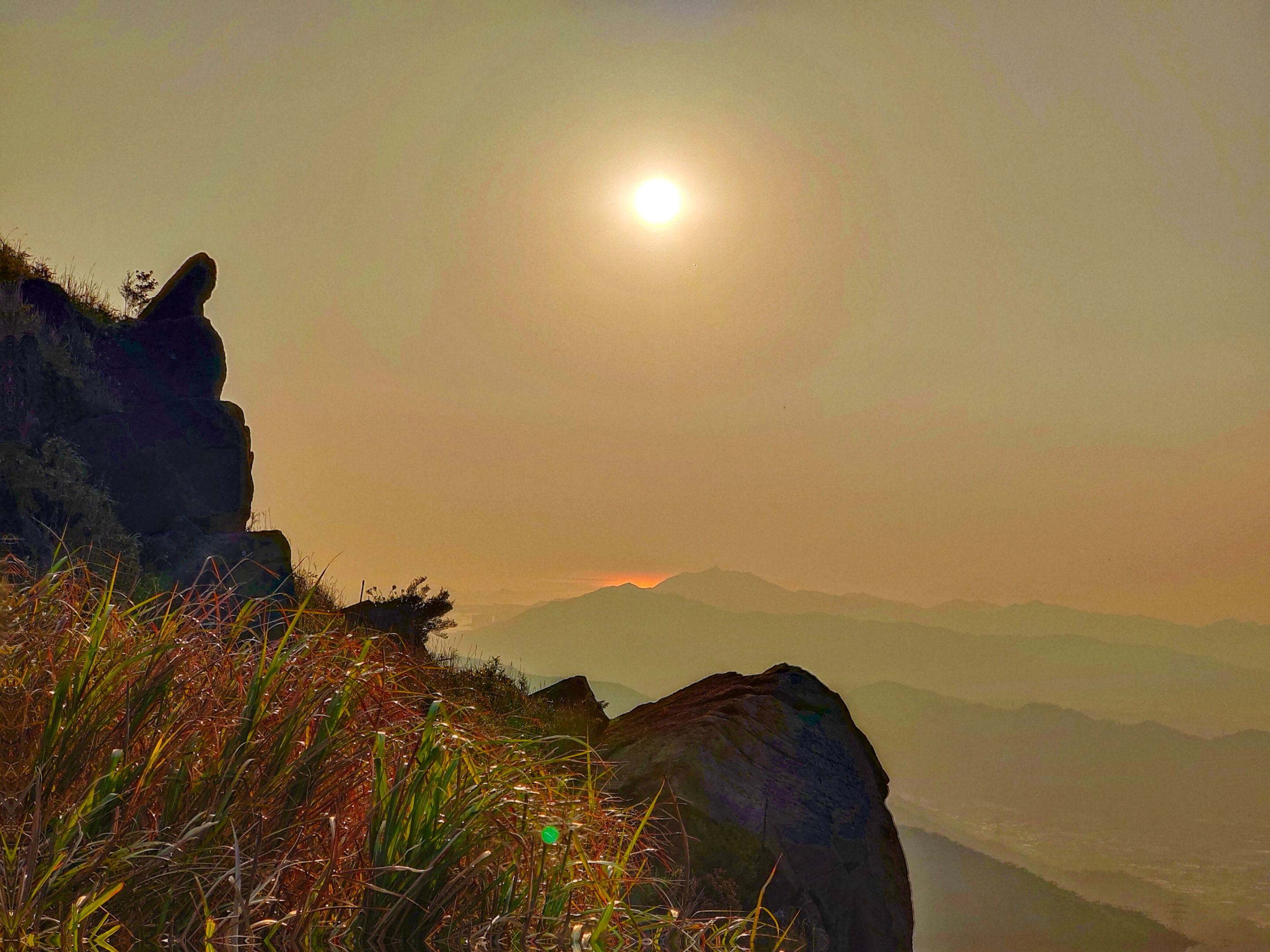
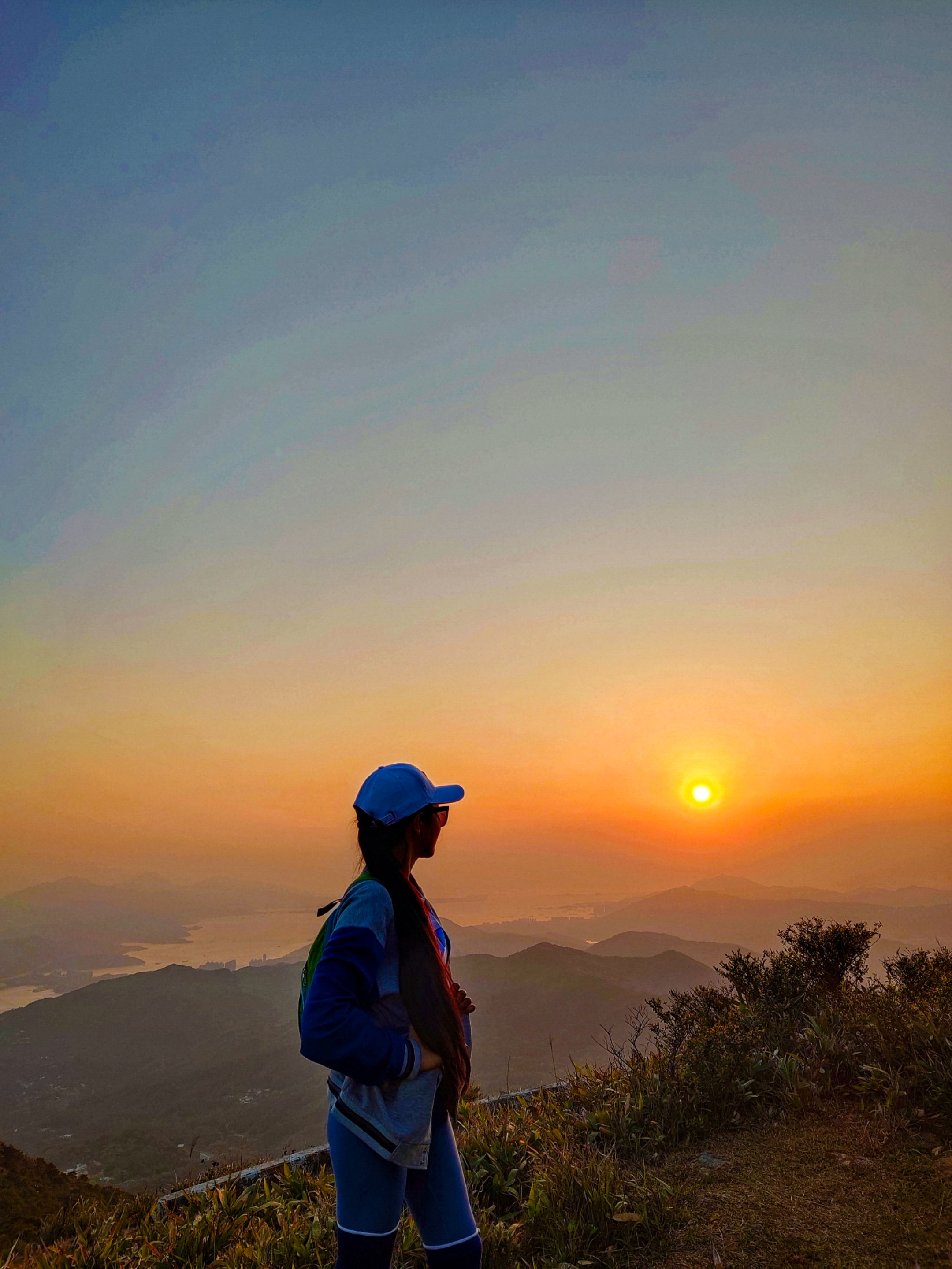
The sunset was so damn beautiful! I was speechless upon seeing the beautiful sunset and cityscapes of Hong Kong on top.
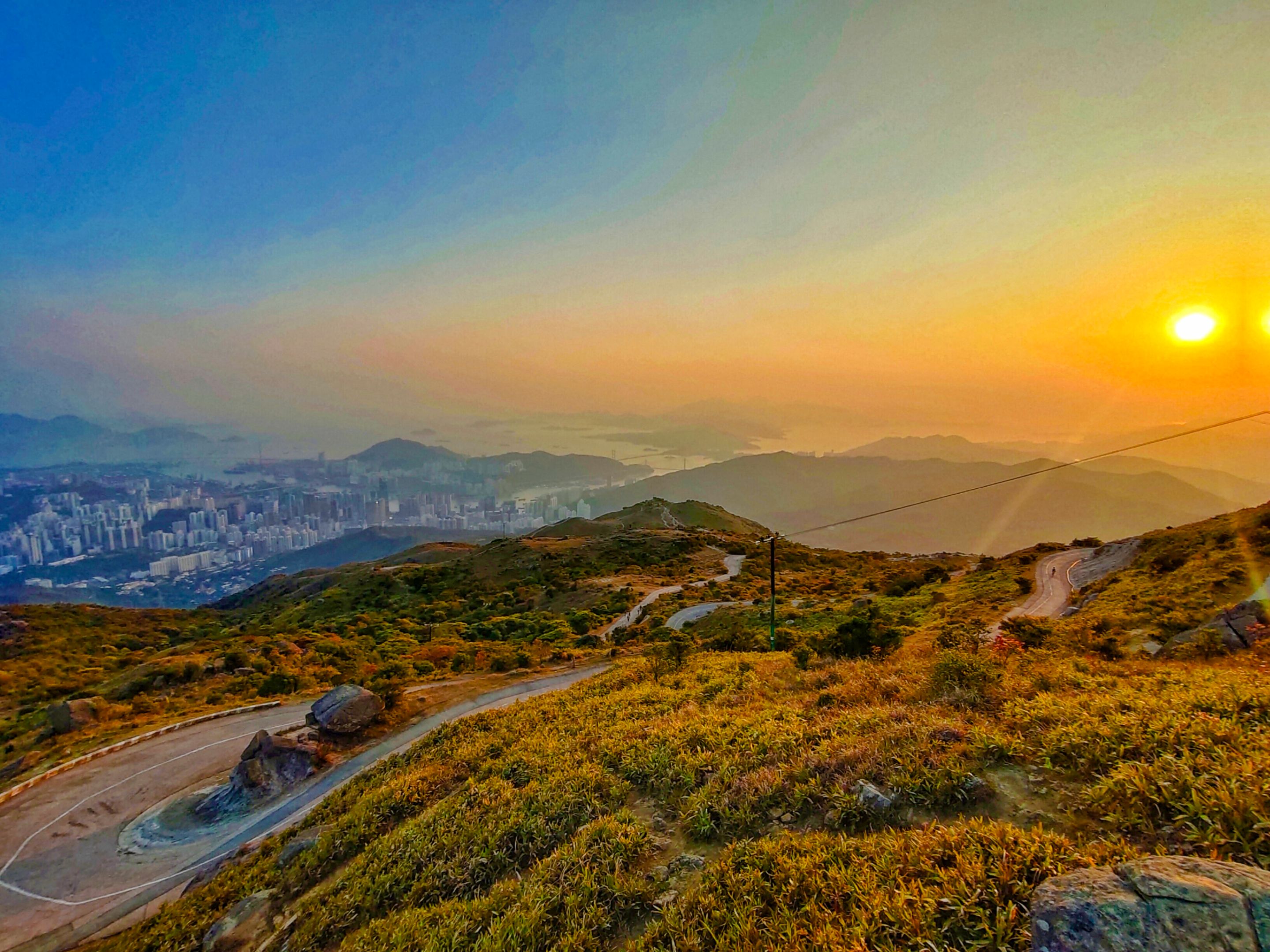
And that's when I realized that there are actually concreted paved roads going up to the highest peak from the base. "Why the hell did I take the jungle?" That was the question that was formed in my mind. But I can't deny that the jungle experience was great and another thing that added to my memories that will remain forever. That is what matters to Jane The Hodophile!
Was I on the highest peak?
No, it's not yet! I continued my way up and followed the ascending concreted paved road. I spotted a family at the edge of the cliff taking photos of the sunset. They seemed had a day camping in the area.
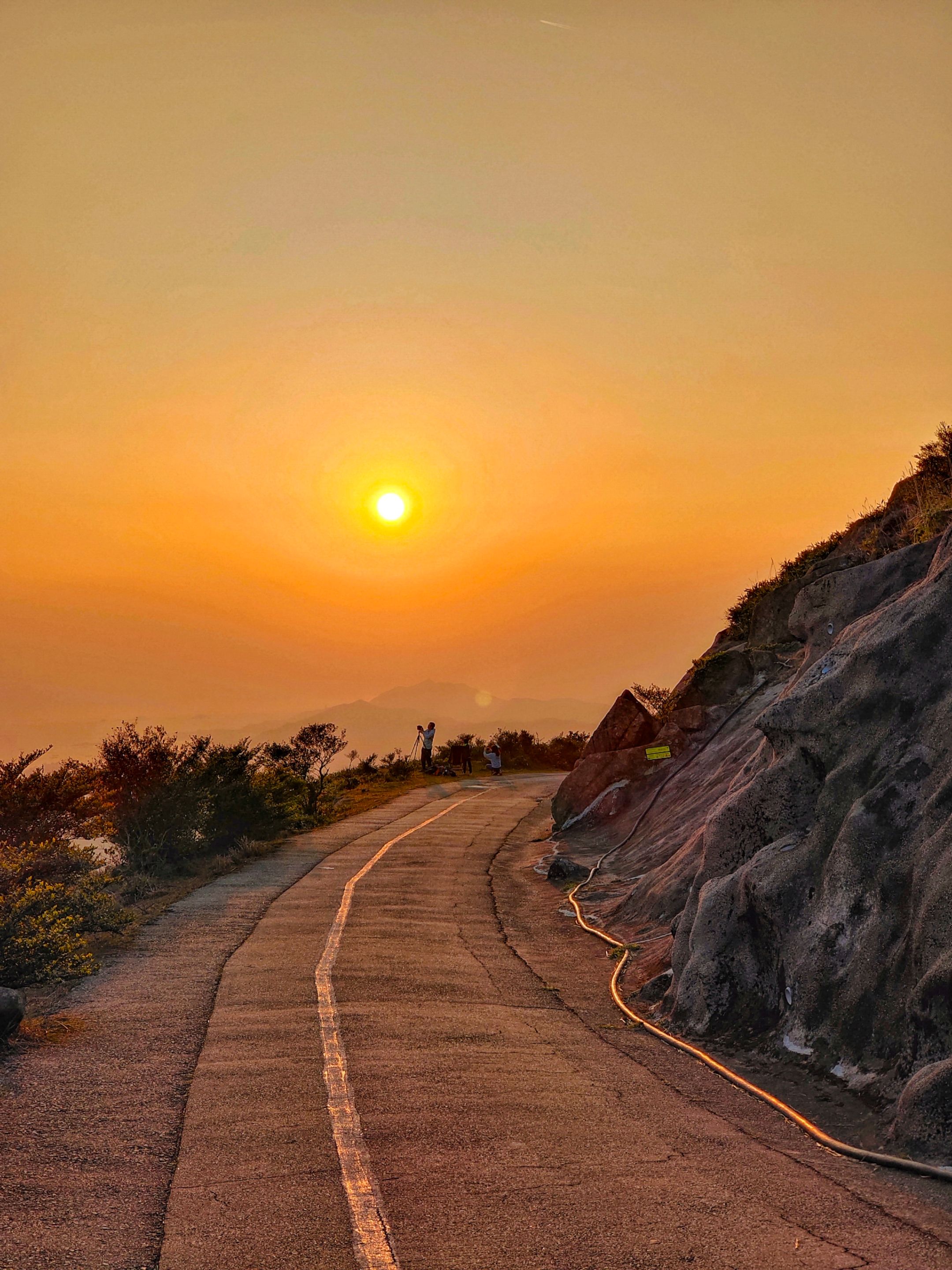
They asked me a favor to take a family photograph with the sunset, and in return, the wife took this beautiful shot. I finally got a souvenir shot of the sunset taken on the highest mountain in Hong Kong!
Was I on the highest peak? No, not yet!
Show more
Tags :
Woo!
This creator can upvote comments using 3speak's stake today because they are a top performing creator!
Leave a quality comment relating to their content and you could receive an upvote
worth at least a dollar.
Their limit for today is $0!
Their limit for today is $0!
2 views
a year ago
$

5 views
8 months ago
$
5 views
a year ago
$

6 views
a year ago
$

7 views
a year ago
$
More Videos

15 views
4 years ago
$

14 views
a year ago
$
4 views
a year ago
$

10 views
a year ago
$

1 views
3 years ago
$

8 views
3 years ago
$

5 views
2 months ago
$

8 views
4 years ago
$

16 views
3 years ago
$

6 views
2 years ago
$

41 views
a year ago
$
15 views
4 years ago
$

8 views
a week ago
$

6 views
a year ago
$

5 views
2 years ago
$

4 views
3 months ago
$

6 views
a year ago
$

6 views
2 years ago
$

8 views
2 years ago
$

19 views
3 months ago
$

0 views
2 years ago
$

22 views
10 months ago
$
Comments:
Reply:
To comment on this video please connect a HIVE account to your profile: Connect HIVE Account